All I see is a huge, brown, furry face staring back at me from the shrubs 10 metres in front of me.
“Holy f*&k,” I say out loud, as I stop dead in my tracks. The grizzly has also stopped and is sizing me up. This is not a comfortable situation for either of us. I slowly back up the knoll behind me to a camp site. The bear keeps looking at me but doesn’t follow. It doesn’t turn around and run, either. I keep looking at it, waiting for the charge. Hoping it will turn and run.
Once I’m beside the truck parked in the camp site, I turn and run to our camp and yell out to the other campers there’s a bear in camp. Jan comes up from the lake shore as I grab my bear spray and bangers, and together we start walking back up the knoll to see if we can see where the bear is.
Too late. In a flash from our right, the bear comes charging full speed past an RV. As we turn, it runs between us and our tent. It’s not instantly clear what is happening but he keeps going and we watch in amazement as this brown brute charges through the camp site.
It’s over in a couple of seconds – it seemed longer – and we run over to where two other campers are standing on another knoll watching in amazement. “Safety in numbers,” I think. Besides, one of them has a fire extinguisher-sized bear spray that puts my puny spray to shame.
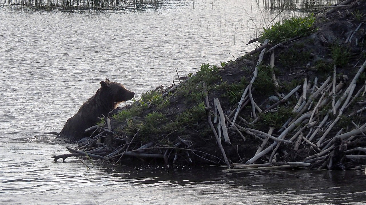
The bear is in the lake and slowly wading out from shore across a small bay to a beaver lodge where not half an hour earlier we had been standing. It suddenly dives under water and I wonder if the beaver is defending its lodge. He comes back up right away and starts to climb out onto the mound.
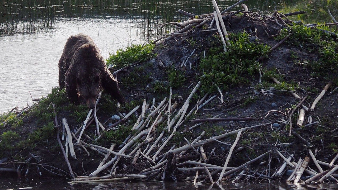
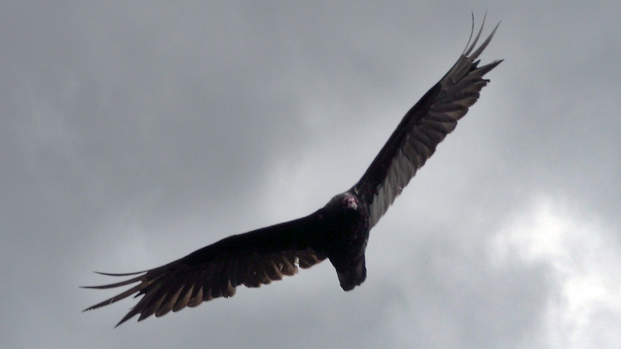
We’re all a bit more relaxed now that the immediate threat is over and we watch this beautiful apex predator sniff around the mound of the beaver lodge. The sun is low in the sky behind it and we can see the water droplets falling off its fur like so many shimmering diamonds. What a gorgeous animal.
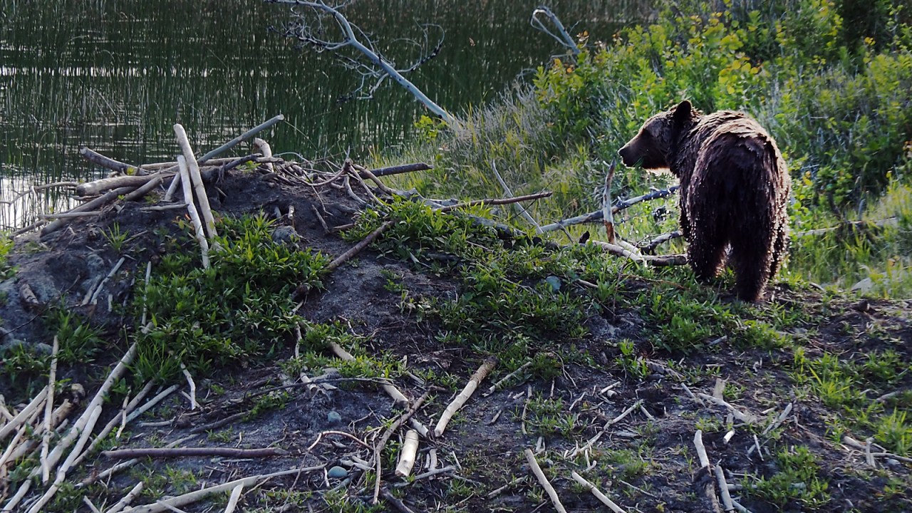
We chat with the other two campers while watching the bear slowly walk and swim away until it’s out of sight. It’s around 7 p.m. and we return to our tent to make dinner. Afterwards, we diligently hang all our food, pots and toiletries from a tree branch four metres up.
I have to stop meeting bears like this. A year ago on Ellesmere Island, my travelling partner John Dunn and I were awakened by a polar bear. The previous year, while sledding east of Great Slave Lake with John, we had a black bear stalk us in our camp. Three years. Three bear species. Three is enough.
With bear spray and bangers close at hand we turn in for the night, feeling secure with less than a millimetre of nylon separating us from whatever may lurk out there in the dark. I sleep like a baby.
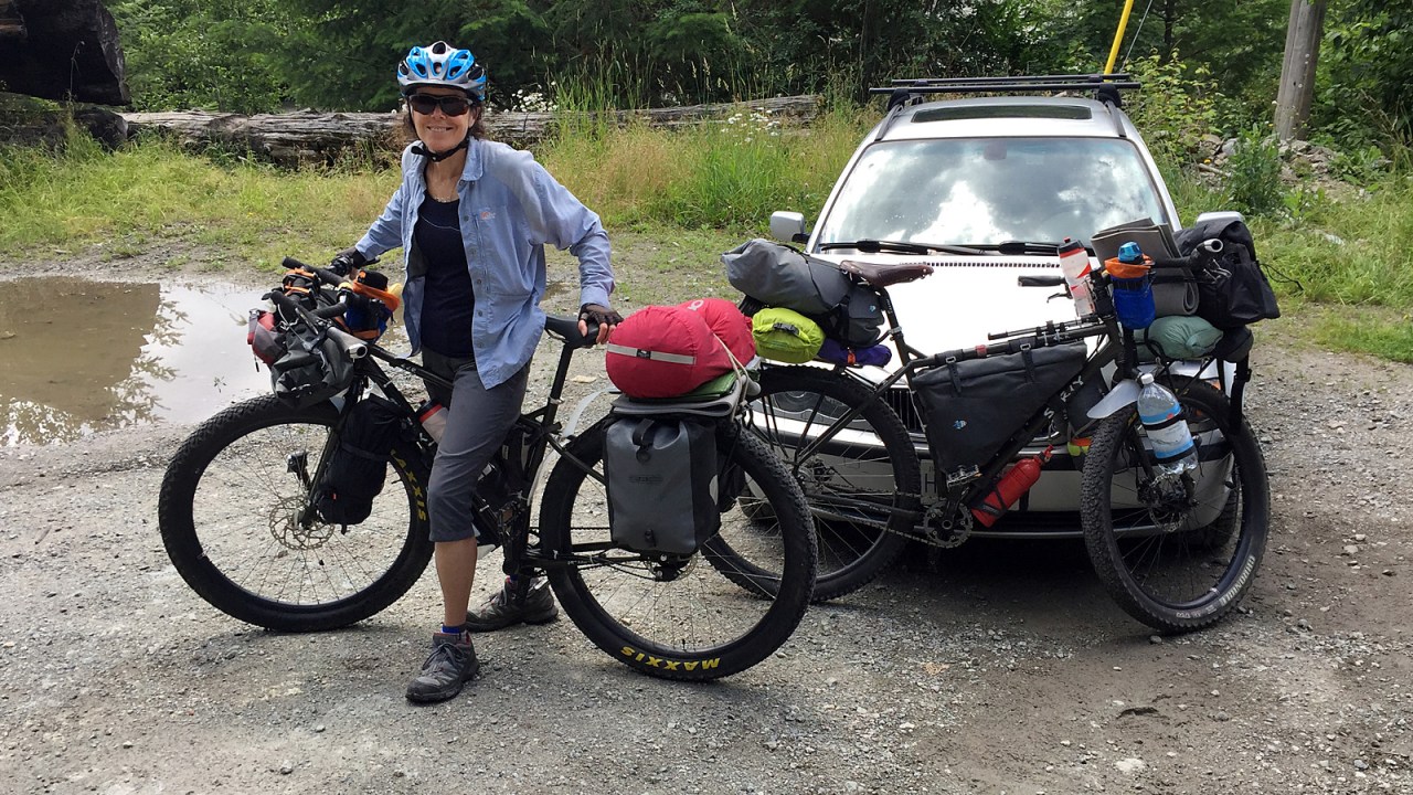
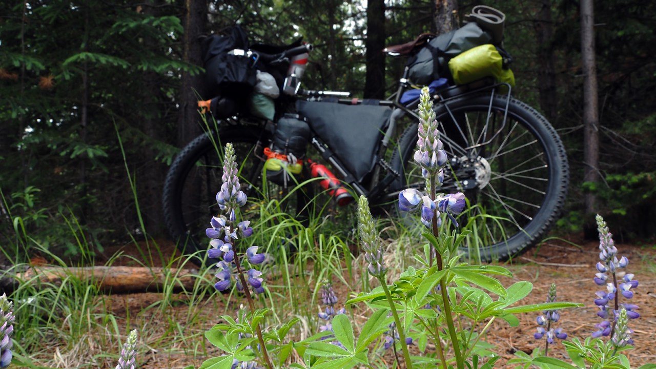
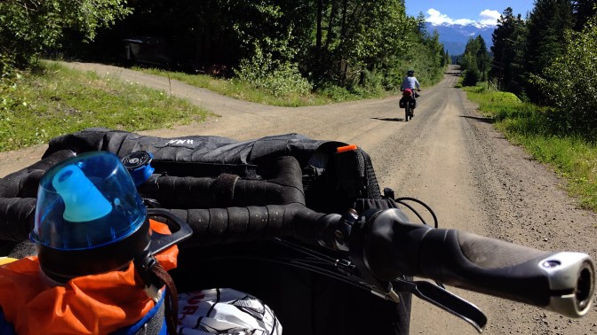
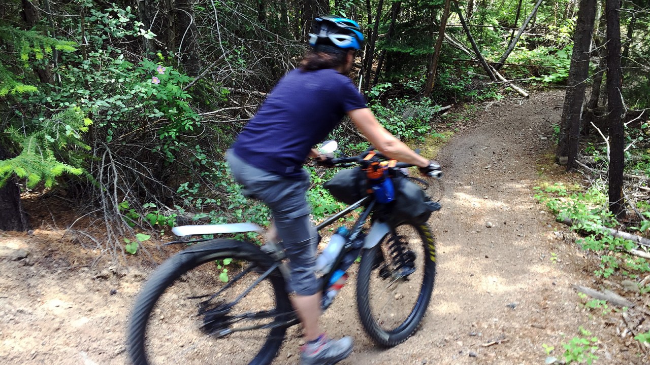
We had started our trip two days earlier. We left the car on the Lillooet River Road near the end of Pemberton Meadows, loaded the bikes and headed up the Hurley Forest Service Road.
The Hurley is steep and rough. For 15 kilometres, the road angles up almost without mercy. Because of our late start, we didn’t get that far, only eight kilometres, when the weather forced us to stop. With dark clouds racing in, we came upon an old side road with enough flat ground to pitch the tent. We got it up just as the downpour began.
The rain pounded our tent for a couple of hours and when it stopped we cooked our dinner outside. We didn’t quite have enough time to finish eating when it began again so we quickly scrambled into the tent vestibule to finish eating. Another respite in the rain gave us an opportunity to wash the dishes and secure our camp before turning in for the night. It was only 8 o’clock.
In the morning, the weather had improved a bit and we continue our grind upwards after a filling breakfast of oatmeal and coffee. Six kilometres and an hour later we gain Railroad Pass at 1,400 metres. A couple of women hikers stop us to warn us about a black bear sow with two cubs ahead and we chat for a while. The sow and cubs pass us in the bush beside the road and we continue north on a downward trajectory toward the Bridge River valley.
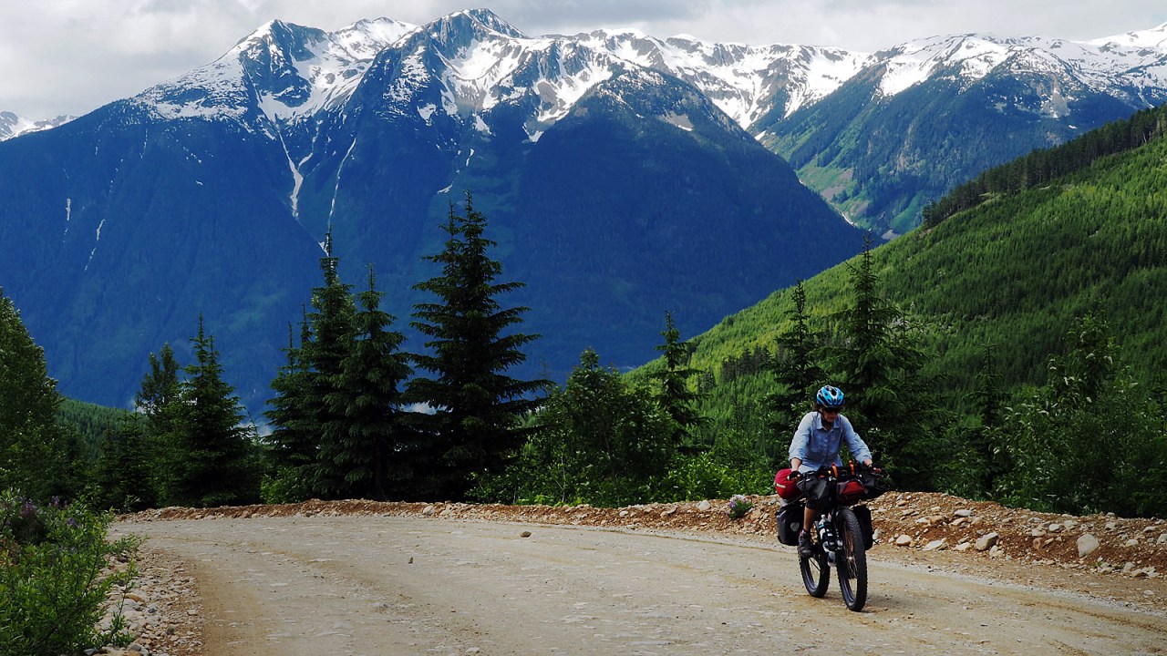
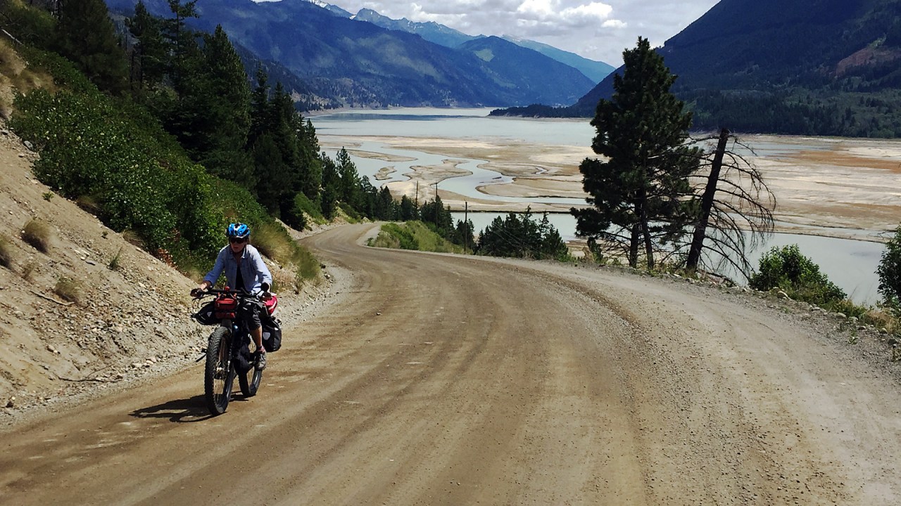
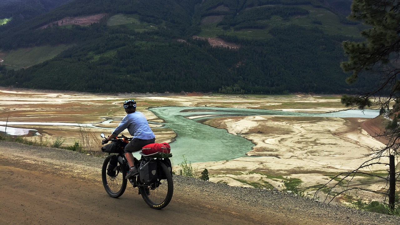
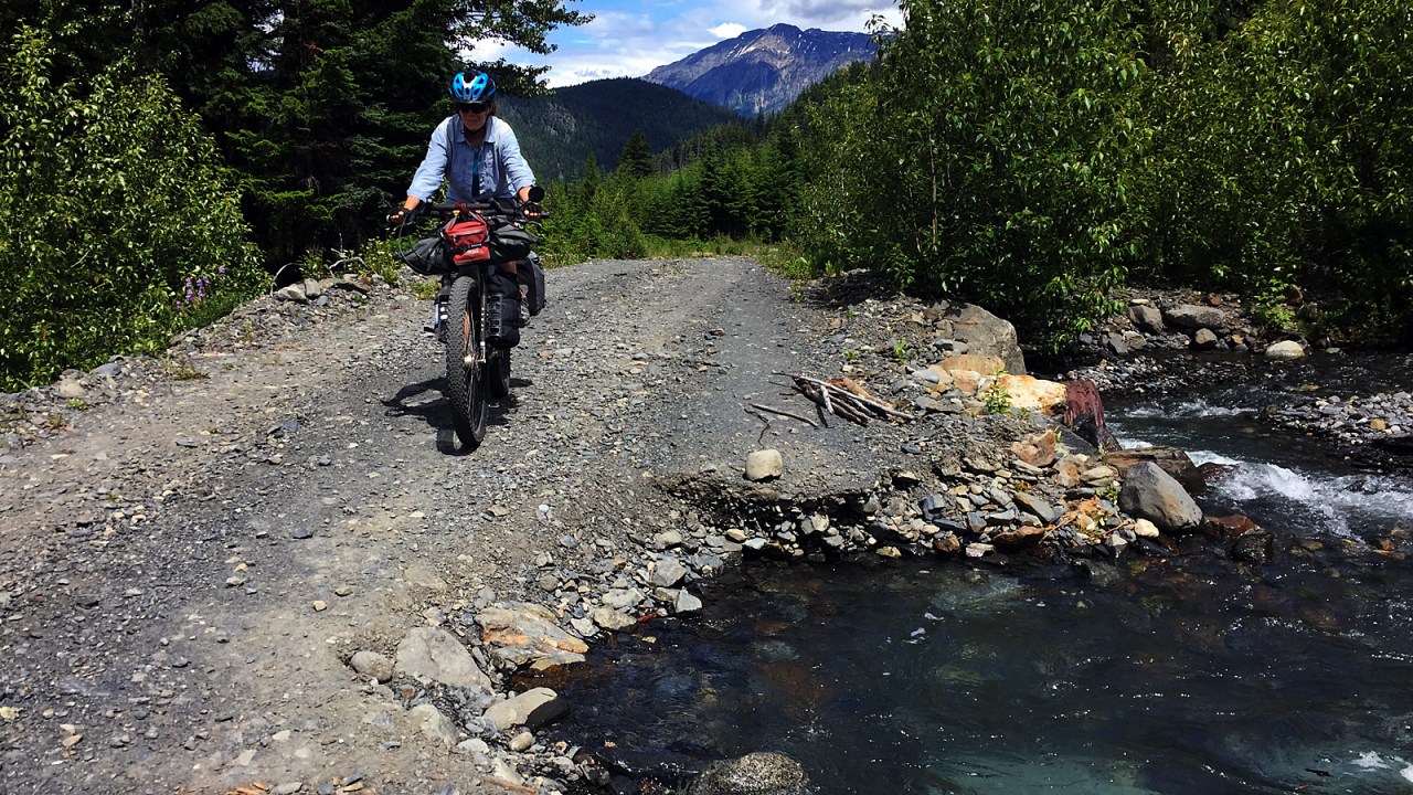
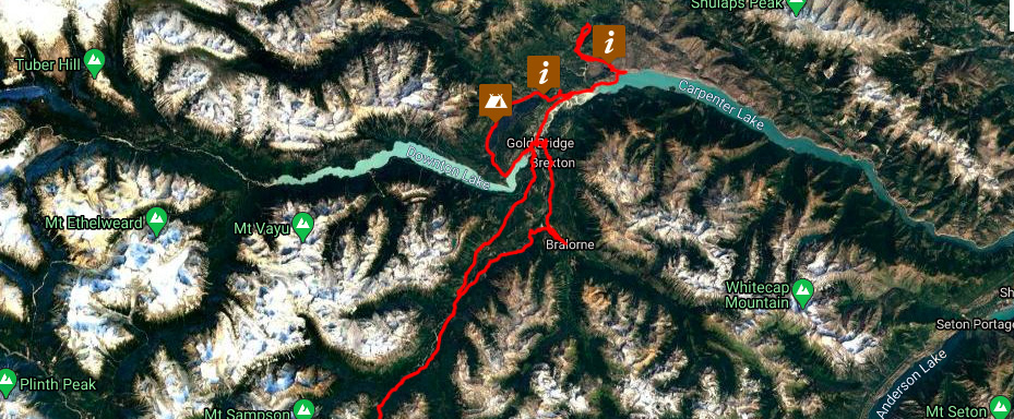
Downton Lake eventually comes into view and we ride our brakes on the steep descent to the bridge across the Bridge River. The river was dammed in the 1940s and 50s as part of a massive hydro project creating Downton Lake, Carpenter Lake and enlarging Seton Lake. The water from the river is used three times before it flows into the Fraser River, and generates six to eight per cent of British Columbia’s power.
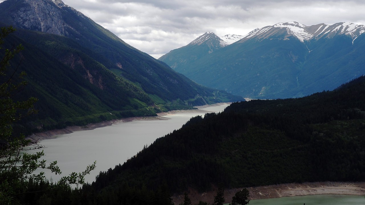
The water in Downton Lake is still low as the snow melt has not yet finished. We turn onto the Gun Lake Road above Downton Lake and ride past the Lajoie dam. It’s an impressive structure. The road is paved but it doesn’t make the climb any easier with grades up to 14 per cent.

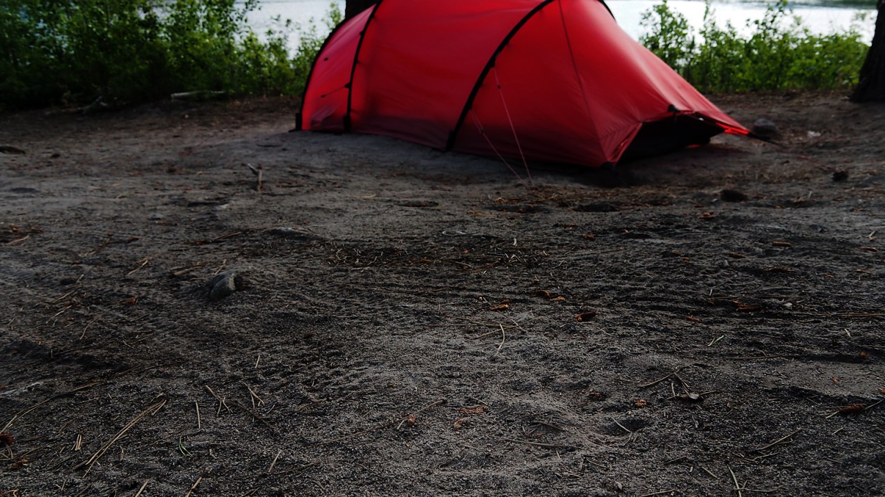
We make camp at the Gun Lake Forest Service Recreation Site on the west shore of the lake. The lake is incredibly clear. Houses have been built all along its shores and this is a popular recreation area for people who have cabins and second homes in the area. The trail system of the South Chilcotin Mountains Provincial Park is a mountain biking destination with over 200 km of trails through grasslands, sub-alpine and along alpine ridges.
We are here for a little taste of the Chilcotins in preparation for a longer, more ambitious journey later this summer. The Covid-19 pandemic is forcing us to stay close to home and we feel lucky to live in British Columbia where there are endless choices available to us for some homegrown adventure travel. There are only two other occupied camp sites at the small Gun Lake campground.
As the province is only just beginning to open up, we are conscious of being outsiders in small communities and have brought everything we need for this five-day trip. No need to buy any groceries and camping every night, this kind of travel is perfect for these times. Nothing new for us. We always do this.
We have leisurely dinner as the light fades. It was a good ride today: 52 km and 1,200 metres of climbing. We plan to have a shorter day tomorrow and ride some trails.
I’m up with the birds at 4:30 a.m. but I don’t get out of bed yet. I just doze and listen to the dawn chorus. I must have fallen asleep again because when I wake up I see the sun on part of the tent and it’s warming up. I quietly exit the tent as to not wake Jan, and set about making coffee. It’s 6:30.
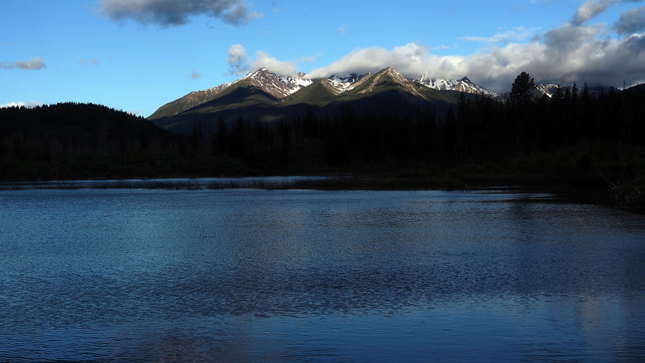
I watch the sun slowly light up the mountains while sipping the hot, bitter espresso. Birds flit among the trees and the smell of the pine trees fills my nostrils. I love the still morning air before any one else is up. I make another pot of coffee when Jan gets up and we have our oatmeal breakfast.
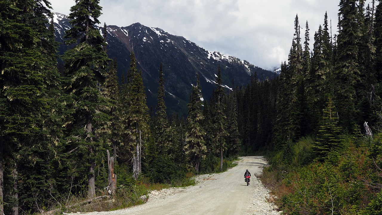
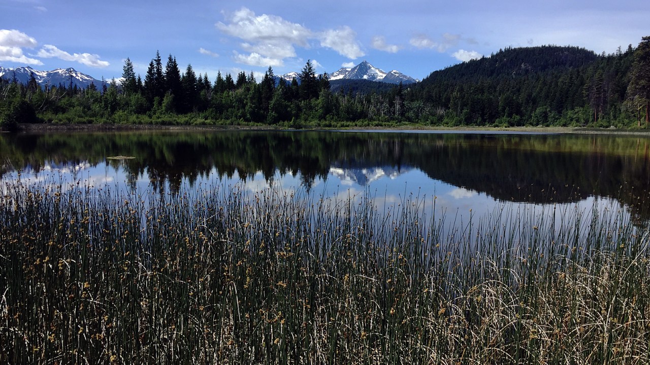
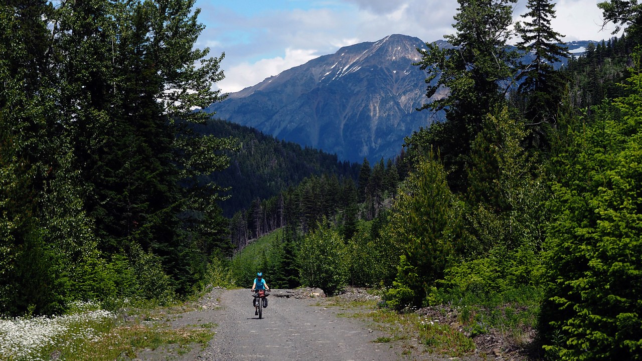
We break camp, pack the bikes and head back out to the road. At the north end of the lake, we take the Slim Creek Mainline Road. It’s a gently meandering road through the forest with occasional views of the mountains on the south side of Carpenter Lake. We make a short detour to Plateau Ponds, reflecting the mountains to the west in the clear water.
The descent on the Slim Creek Mainline is steep and has a small rock slide just above the Carpenter Lake Road. We slowly ride across, hoping nothing else will slide, and get on the pavement along the lake.
We had planned to stay at the camp site on Gun Creek but the BC Hydro-run site is closed due to Covid-19. We easily ride past the concrete barriers and contemplate camping there anyway but decide against it. We meet a family of three walking through the campground, also disappointed about the closure.
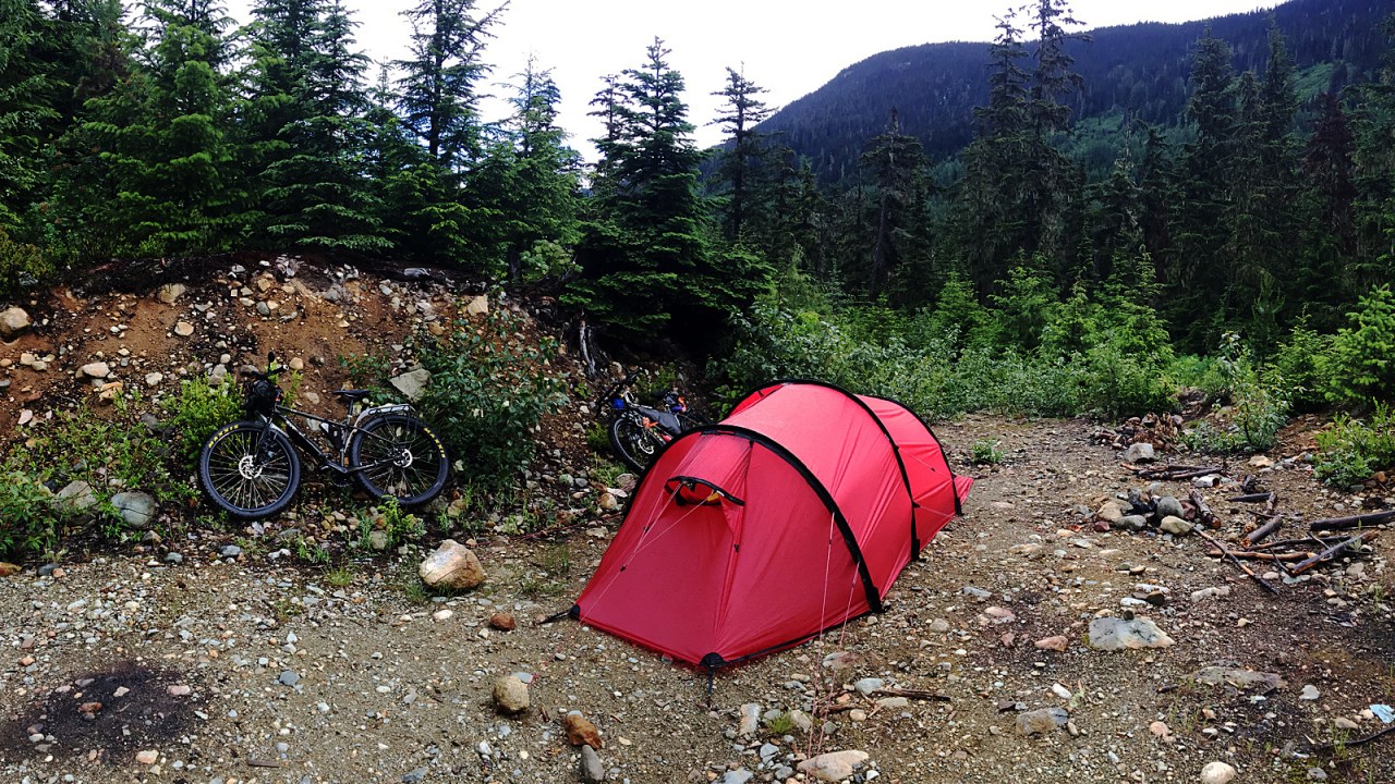
After a snack, we ride four kilometres further along the lake and take the Tyaughton Lake Road up to Mowson Pond. It’s a steep two-kilometre climb but the reward is a gorgeous lake-side camp site with sweeping views of the surrounding mountains.
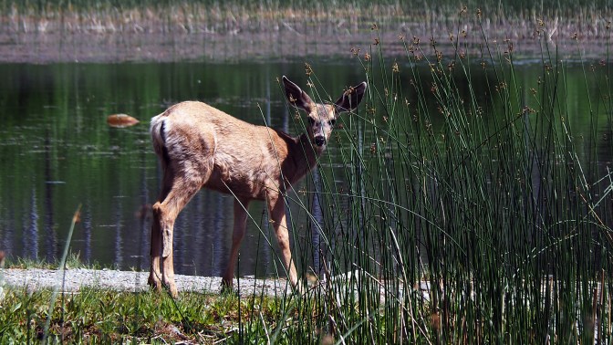
There is a premium lake-side site available and we unload the bikes. A black-tail deer grazes along the lake shore nearby as we make camp. After lunch, we take our now unloaded bikes up to Tyaughton Lake. I’m surprised to see so many homes along the lake shore. At the north end is Tyax Lodge, a well-known destination lodge offering all kinds of high-end year-round adventures from hiking to heli-skiing.
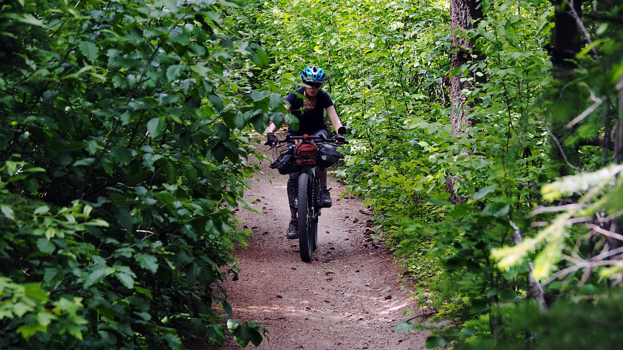
We head up a single track trail that slowly climbs through a couple of switch backs. We can ride most of it, pushing the bikes up a short, steep section before it levels off. It’s a fun ride on the narrow trail as it slowly opens up into an old clear cut with great views to the south and west.
We continue on single and double track meandering down parallel to the Tyaughton Lake Road, eventually dumping us out on the Gun Creek Road and a short ride back to our camp site at Mowson Pond. Parked next to us is the family we met earlier in the day at the Hydro site.
A couple of hours later we have the grizzly bear encounter in our camp site. Afterwards, I look for the bear’s paw prints and find a good one only a few feet from our tent where the bear had galloped past before jumping in the lake.
We sit around the fire with our neighbours later, chatting about the bear and other adventures. The sun is down and before darkness envelops us completely, we hoist our food and toiletries into an overhanging tree branch and make sure we don’t have any obvious bear attractants in camp.
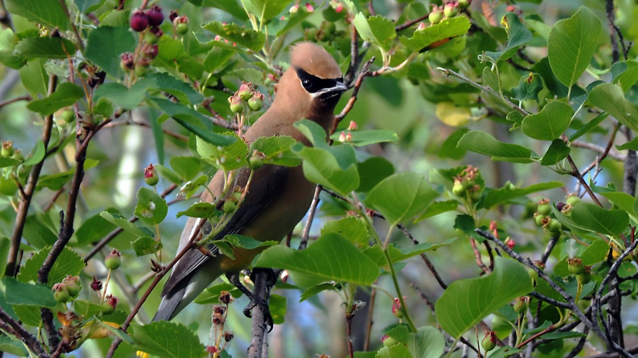
After a good sleep, I repeat my morning ritual in the quiet of the dawn. I photograph some cedar waxwings sharing the morning with me. A loon trolls the lake. There is no sign of any bears.
We break camp and head back down the road, stopping on the other side of Mowson Pond where a family of four is camped. We met them the day before and tell them about the grizzly encounter so they’re aware as they plan to stay there for a few days.
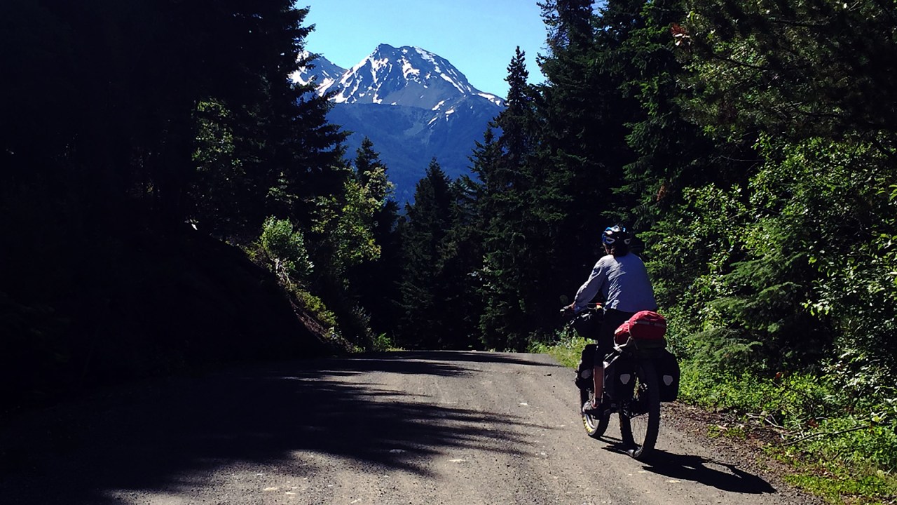
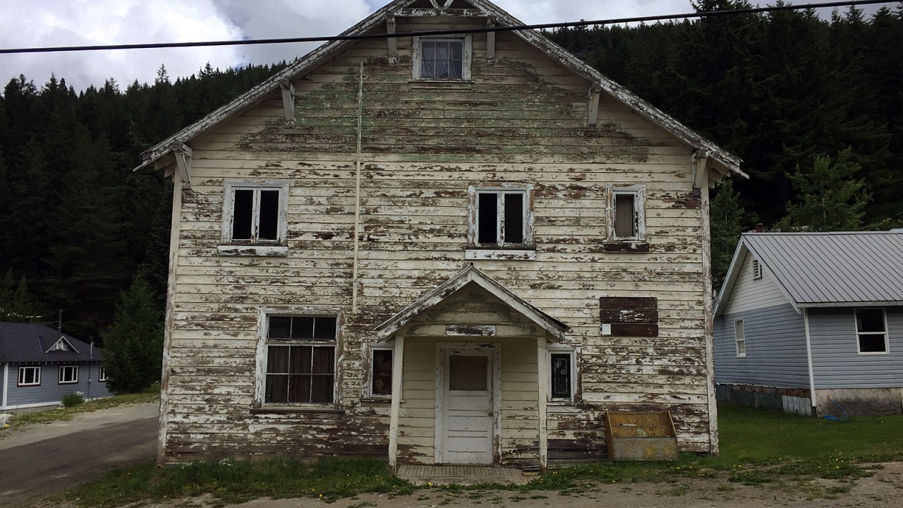
We ride back along Carpenter Lake to the town of Gold Bridge. It’s quiet with nobody around. We try to get some information about the condition of the East Hurley Road south of Bralorne but the proprietor of the hotel has no current update about a wash-out. We go anyway.
The road to Bralorne is paved, making the six-kilometre-long climb a little easier. Once we’re on the ridge, there are spectacular views south looking into the Hurley River canyon.
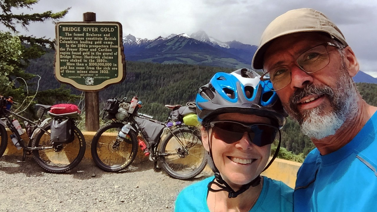
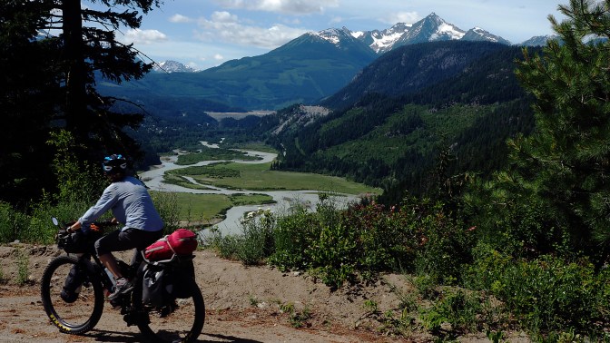
Bralorne is also quiet. We ride a short loop through town before taking the East Hurley River Road down to the Bralorne Gold mine. Past the mine, we cross the bridge over Cadwaller Creek and ride south along the Hurley River through forest and clear cuts. It’s a great ride with beautiful views and only two vehicles slowly pass us heading north.
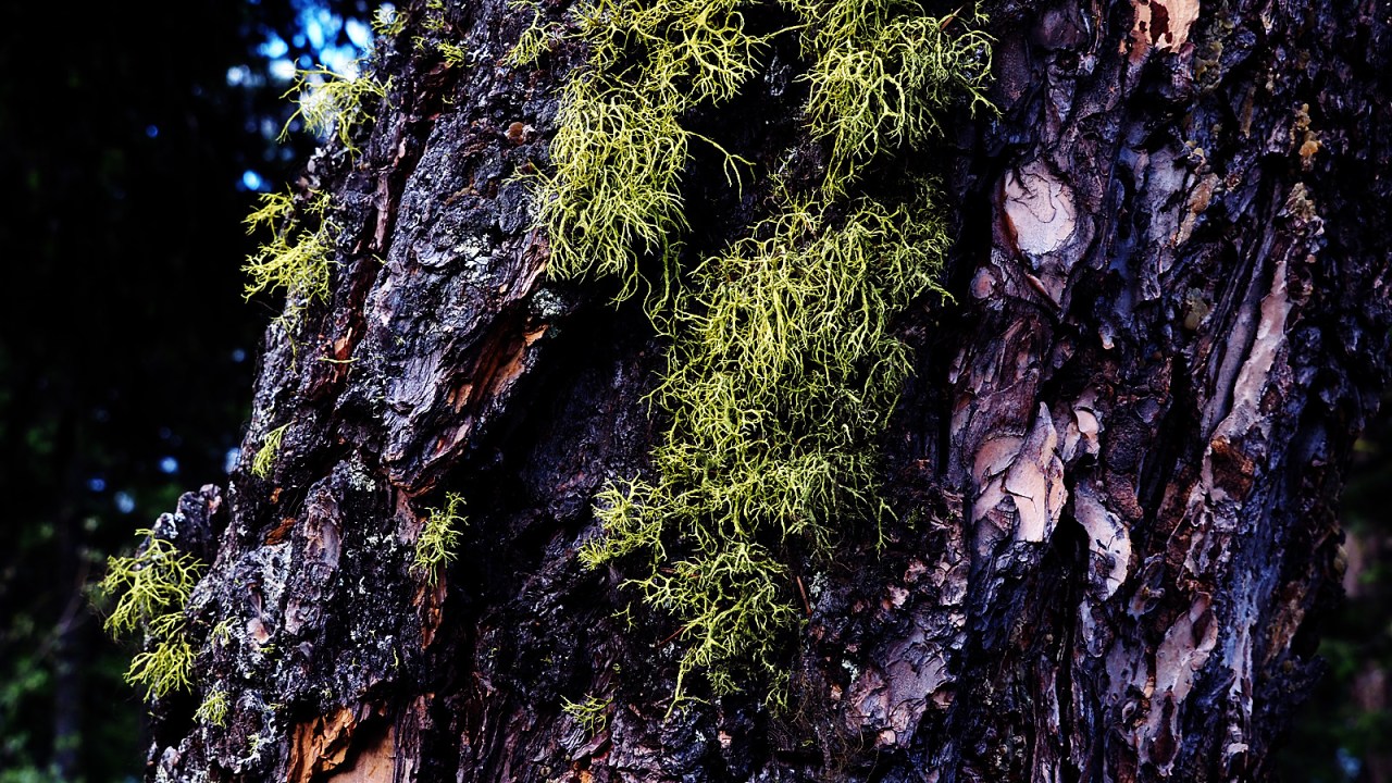
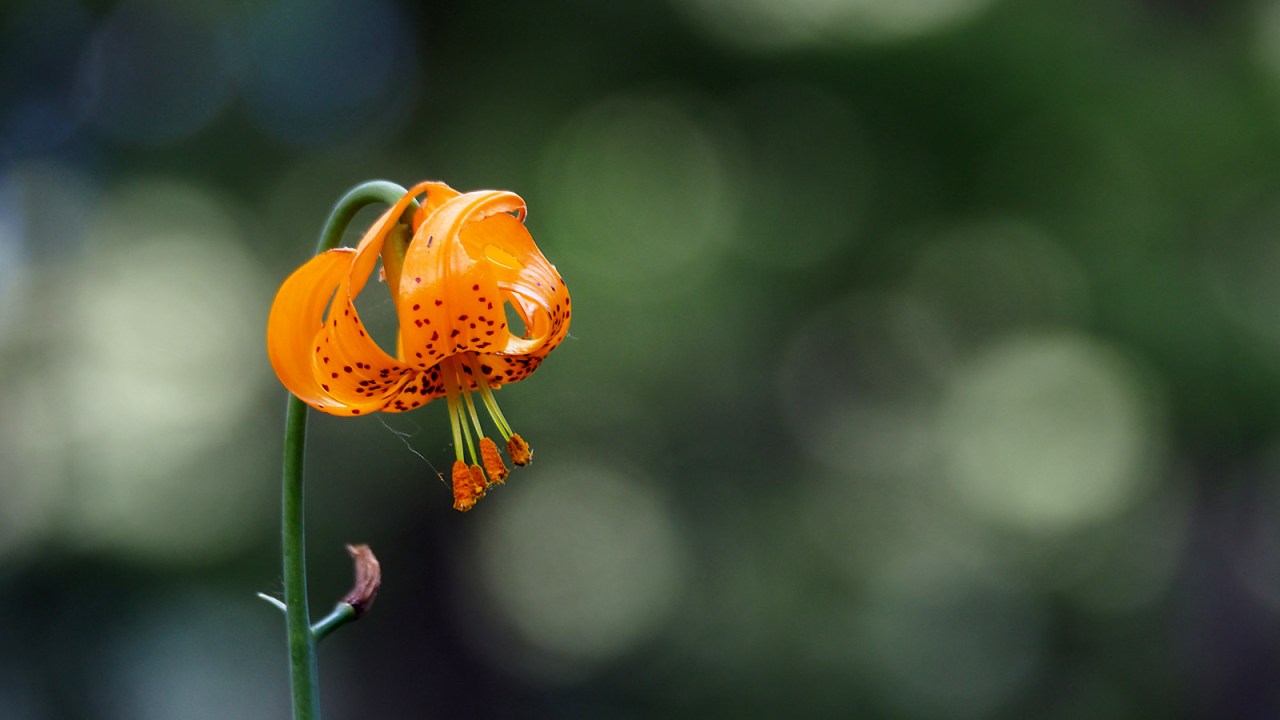
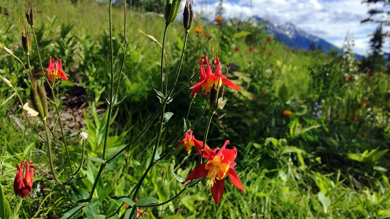
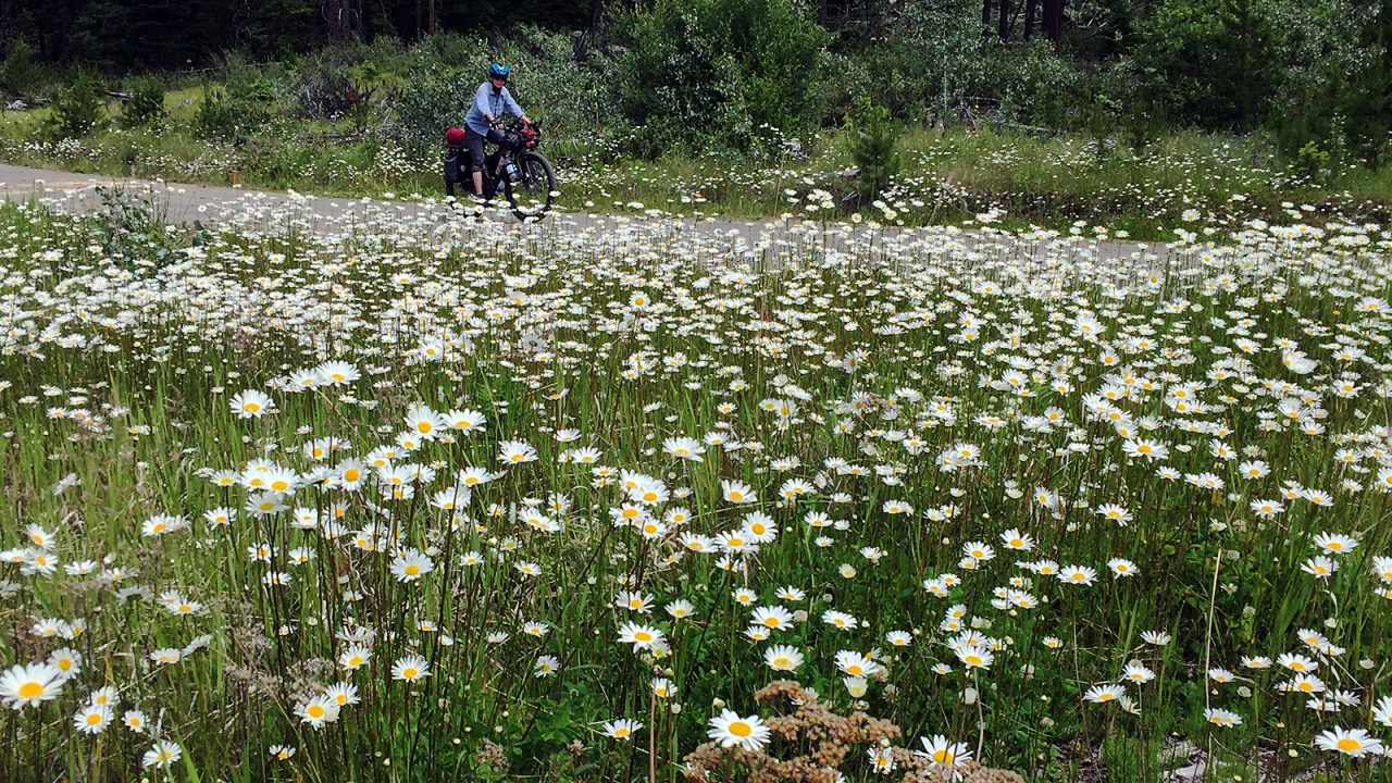
Wild flowers are blooming everywhere and the smell of the wild roses is intoxicating. We ride slowly to make it last as long as possible, stopping frequently to make photographs.
Three kilometres before the junction with the Hurley FSR is the wash-out we knew about. Nearly half the road has been eroded away by the raging creek. Recent rain has only added to the problem. Who knows when it will be repaired and if more trucks take the road the fragile edge of the road bed will deteriorate even further. It presents no problem for us.
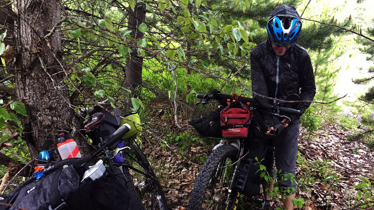
We have a snack at the junction and decide to continue up to Railroad Pass and perhaps find a place to camp. Not long after, a storm is brewing behind us in the north. We keep riding, hoping we might just stay ahead of the system but it quickly becomes apparent that is not going to happen.
With the first rain splatters we pull over to get our rain gear on and in moments it’s hailing and we scramble into the bush beside the road to find shelter under a tree. Covered in gore-tex, we have another snack and let the worst of the squall pass before continuing.
The rain continues steadily as we get to the pass and we decide not to camp but rather ride the 15 km down the mountain and back to the car. The temperature has dropped and it’s a challenge to negotiate the muddy, boulder-strewn road. We are riding the brakes so as not to get going to fast but the cold makes it hard to keep squeezing them. We have to take frequent breaks to slap our hands together to get the blood to flow.
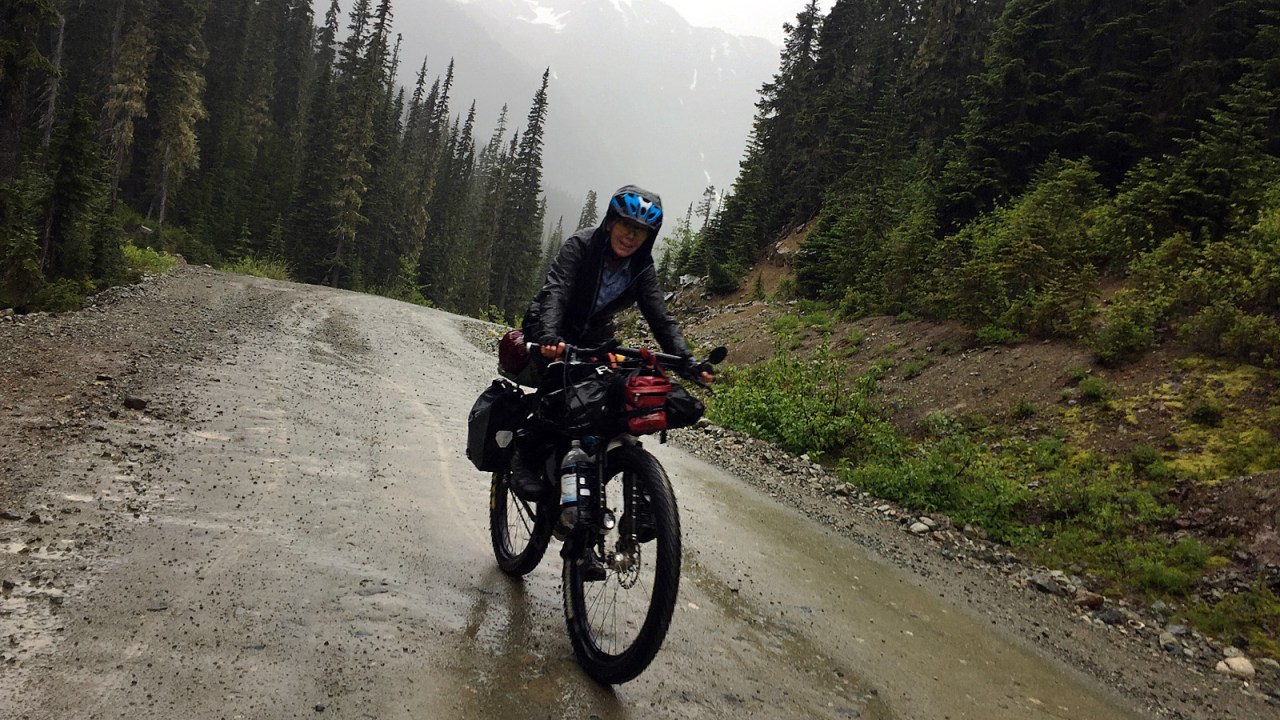
As we descend into the Lillooet River valley, the rain stops and the sun comes out. But it remains unstable behind us and ahead of us in the Pemberton Meadows valley, more dark clouds loom.
Thankfully, it doesn’t rain on us for the last five kilometres down to the valley bottom. The eight kilometres along the Lillooet River seem endless after the long, fast descent from Railroad Pass but we eventually get to the car, happy it’s not raining and thinking about getting to Pemberton for a hot meal.
We strip the bikes and ourselves of muddy gear, load everything into the car and head to town for a burger and a beer at the Mile One Eating House. We get there just before their 8 p.m. closing. It’s the best burger ever!
Despite having to cut the trip short by one day, we had a great ride. It’s a hilly ride with nearly 4,000 metres of climbing and 180 kilometres on mostly gravel roads and trails. It was an excellent primer for the next long trip we have planned for August and September when we will come back through this area.

Awesome!!! You two rock (so does the grizzly)!
Great post. Sounds like an amazing adventure (maybe too close an encounter with the grizzly?).
Good one!
Paul and Jan,
Read you bear story. Sounded scary.
Where are you now? In the city?
Lise and I are here in Vancouver.
Might be time to have that breakfast we talked about.
Let me know you can fit breakfast into you busy schedule.
Wayne Helfrich
Great blog as always. I love reading about your travels and admiring your photography. Thanks so much for sharing. Stay safe 😊
Thank you.
Hi Paul and Jan.
Great adventure. I have some really good aerial shots of the Gun Lake area. When we stayed at Tyax we chartered a plane and flew to Whistler and around Gun Lake. It is amazing country.
Stay away from the bears. You know the expression,”Three times lucky.
Stay safe. Karen K.
Sent from my iPhone
>
Thanks, Karen.
Great story Paul. You guys are incredible. Enjoyed this post. Barbara
>
Thank you.
Beautiful pictures! Thank you both for sharing. please, above all, keep safe<3 ❤
Yup, you two amaze me. Great account.
Thanks, Sandy.
Hi Paul, Great ride, you have brought back some memories of when Bradley, Justin and I rode from Pemberton to Hurley around Carpenter Lake up to Mission Pass down to Shalath and Seton Portage, Darcy and out to Pemberton ideal for some back country riding, I like you Bikes!! Keep up the good work! CC
Thanks, Chris. That loop was our plan but the Highline Road was closed because of a slide, so we improvised.
Great blog! Maybe we do it one day and use this and your great maps as a guide. We have a common friend Chris Cooper and Chris Czajkowski.
Thanks, Len. We have met once or twice.
Thanks, my memory must be really bad.