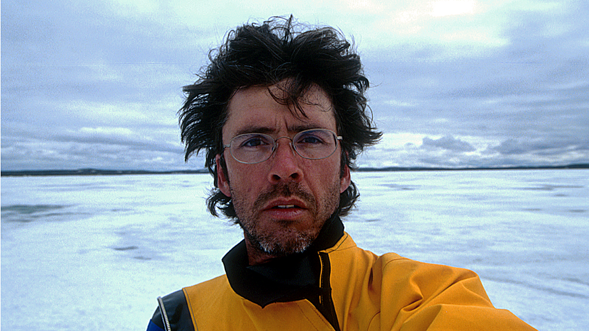
I’ve been thinking about isolation lately. You probably have, too. I’ve had some experience with isolation, however, it was very different from what we are all currently experiencing.
In the summer of 2001, I spent two months on a solo canoe expedition in the Northwest Territories and Nunavut, retracing a route travelled by John Franklin and his crew in 1821. This was the second of four expeditions in the north retracing routes explored by Franklin and George Back, British naval officers tasked with finding the Northwest Passage.
Back’s exquisite watercolours drew me north to explore that northern landscape in 1999, 2001, 2002 and 2004. Eventually, these northern expeditions formed the basis of my master’s thesis on Back’s art work from his three 19th century expeditions.
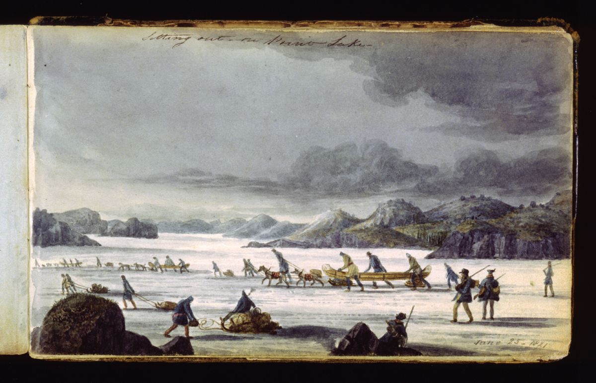
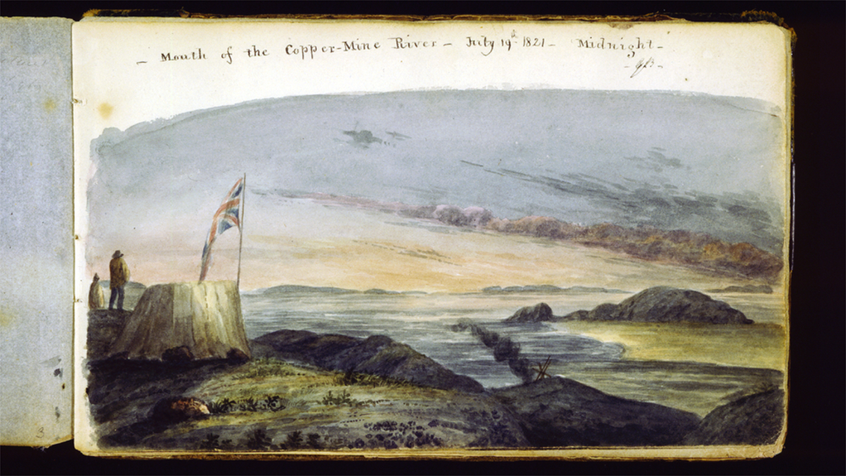
from one of George Back’s sketch books.
What is the impulse to leave home and undertake such an arduous journey? I wanted to see the places Back had painted and freely wander in those landscapes; to touch the ancient rock of the Canadian Shield; to see the animals. But most of all I wanted to experience the land on its terms – to have, as Barry Lopez describes in Arctic Dreams, a conversation with the land.
Undertaking a two-month solo canoe trip was at first a daunting task but once I broke it down into manageable pieces, most of the anxiety around it disappeared, and I just worked to check off all the things on my list. Before long, all the pieces fell into place. A few sponsors came on board and I received some grant money from the Royal Canadian Geographical Society. By early June I drove my old Toyota wagon north to Yellowknife with a yellow canoe strapped to the roof and all the food and gear packed in the back.
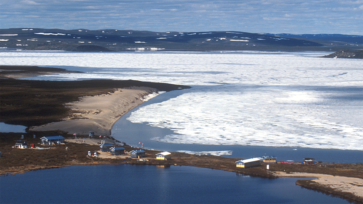
In Yellowknife, I did a slide presentation at the Prince of Wales Museum about the 1999 expedition from Great Slave Lake to the mouth of the Back River, a journey of over 1,100 kilometres and two months. Afterwards, I met Jim Peterson who invited me to stop in at his lodge on Point Lake and offered to take one of my food packs to the lodge, saving me a lot of weight to carry on the first leg of the journey.
The next days were spent sorting out final details. I purchased additional supplies, and mailed a resupply to the hamlet of Kugluktuk at the mouth of the Coppermine River. I also finalized arrangements for chartering a float plane to drop me off at Winter Lake about 300 kilometres north of Yellowknife. And then it was just waiting for favourable weather to fly out.
On June 12, I received word the weather was good for flying. Once in the air, canoe strapped to the struts of the float plane, I looked down on the ancient, glacier-scraped landscape and the reality of what I was about to do sank in. All the anxiety returned in an instant and I puked in a little white bag made for just such an occasion. But there was no turning back now.
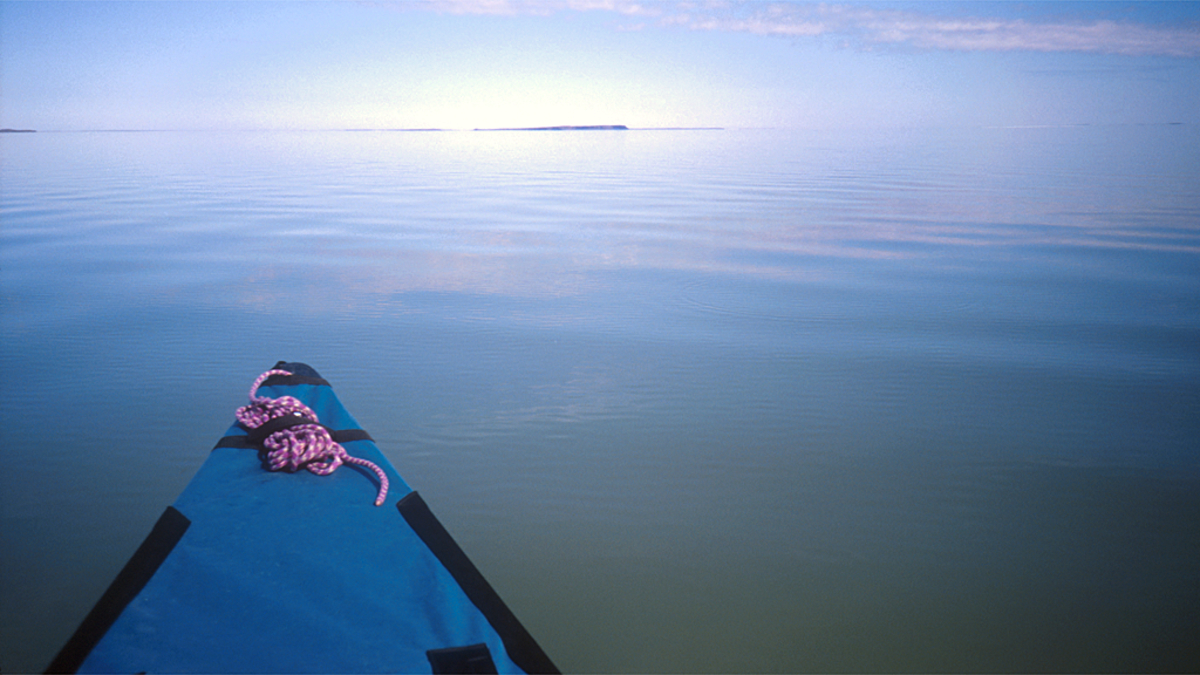
The plane landed on a patch of open water on a still mostly frozen Winter Lake and the pilot helped me unload, piling everything on the sandy beach. He wished me luck, pushed the plane off the beach and started the engine to taxi away. A few moments later, the plane was in the air and disappeared over the trees to the south. It was utterly quiet except for the pounding of my heart. I was really doing this.

This was very much a deliberately planned and self-imposed isolation, unlike what we’re going through now. But the skills I picked up during those two months of solo travel have been valuable. We are social beings and need the company of others but we do have the ability to get by on our own when necessary. You’d better like your own company, though.
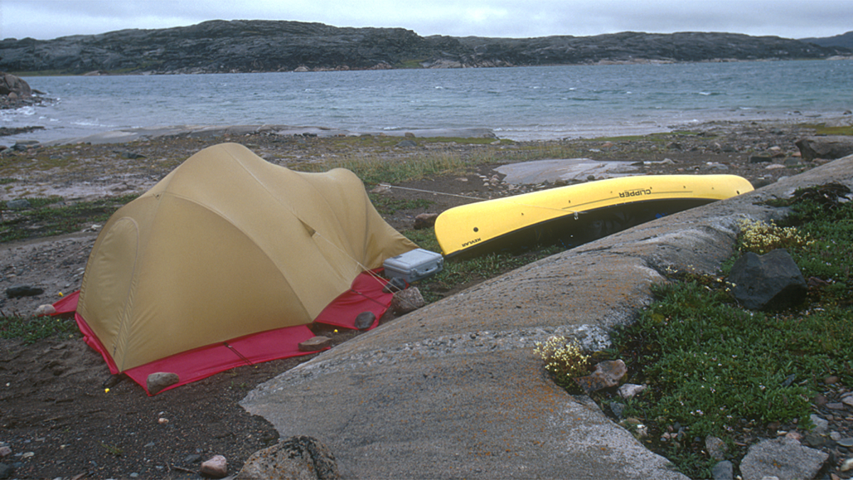
My existence during those two months was very basic. I had brought all my food, not wanting to gamble on catching fish or finding anything else edible. Besides, getting fishy bits on gear potentially attracts unwelcome visitors like bears. I had a sturdy tent, a warm sleeping bag and comfortable inflatable mattress to give me shelter, and enough appropriate clothing for any kind of weather the north could throw at me.
I had also brought several books, the heavy paper kind, as this was the time before e-books. I had several reference books on flora and fauna, journals of Franklin, Back and other officers of the expedition, copies of Back’s paintings, and some books of fiction. Quite a hefty pile of otherwise useless paper that I would have to portage countless times on the journey ahead.
Also in the pile of stuff on the beach were two pelican cases of camera gear, 80 rolls of slide film and a large tripod, as well as notebooks to keep a daily journal and create a record of my journey. At the last minute, I had thrown in an old walkman tape player (google it) and one tape: Miles Davis’ Kind of Blue.
In short, I had everything necessary to survive for the next two months. What I didn’t have was any meaningful communication with the outside world, except a very basic, and heavy, Magellan GSC-100 satellite communicator, that would allow me to send and receive short text messages. I also carried an EPIRB, an Emergency Position Indicating Radio Beacon, to signal for help in case of emergency.

I only used the satellite communicator once – at the end of my journey to summon a plane. Perhaps the biggest difference now is improved communication options when travelling in remote locations. On the last few expeditions, we’ve had a Garmin inReach paired to a mobile phone to send and receive messages, as well as a satellite phone to call home once in a while.
Twenty years ago, we would be gone for six or eight weeks without any contact with the outside world. Now, the urge to constantly feed the social media beast often drive us to post updates about where we are and what we’re doing, especially if there is any kind of sponsorship involved in an expedition, although we have resisted that on the remote journeys as satellite time is expensive, especially for posting photos and video. We generally post a daily position to loved ones so they know where we are, in case they care. It’s also helpful if for some reason communication stops and no calls for help go out. At least there is a starting point for searchers to begin looking.
Before I made camp on that quiet beach I set up the stove to make a cup of tea and have something to eat to get rid of the acid taste in my mouth after puking on the plane. I needed to settle down and get rid of the jitters. The simple act of preparing food helped calm me down and reassured me I was okay.
“Just focus on the task at hand,” I told myself, lighting the stove and waiting for the water to boil. Preparing food has always been an act of therapy for me. It was then and it is now in this time of self-isolation and social distancing, and I feel well prepared for the coming months – as long as the food supply doesn’t suffer too much interruption. I feel lucky to have a wife and partner to go through this pandemic together. Jan and I have had lots of practise being together 24/7. In 2013-14, we spent 16 months cycling through Europe, the Middle East and South America together, and we’re still married. There were other trips before that and there have been others since. The most recent long journey was six months of cycling in Australia and New Zealand.
With some food in my stomach, and a cup of tea in hand, I wandered around the site of Fort Enterprise in the everlasting Arctic evening sun, thinking about what it must have been like here for those 19th century explorers and the indigenous Dene who had made this place their home for many centuries before the arrival of Europeans.


“What are you doing here?” I asked myself. “So many things could go wrong. The canoe could swamp in a rapid. You could break a limb or be attacked by a bear.”
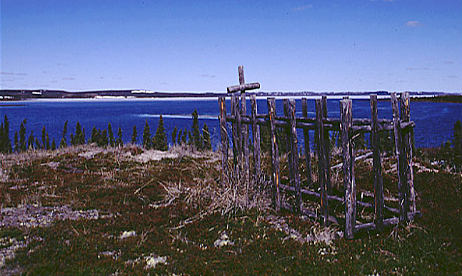
I voiced these fears, speaking them out loud to myself and the land as I climbed an esker. On top, I found an old grave overlooking Winter Lake, and I promised myself I would continue as long as I felt safe. My conversation with the land had begun.
There is no obvious evidence of Fort Enterprise any longer, other than a clearing in the sparse forest. Not far from there, the trees disappear altogether as the tundra stretches north and east as far as imagination can comprehend.

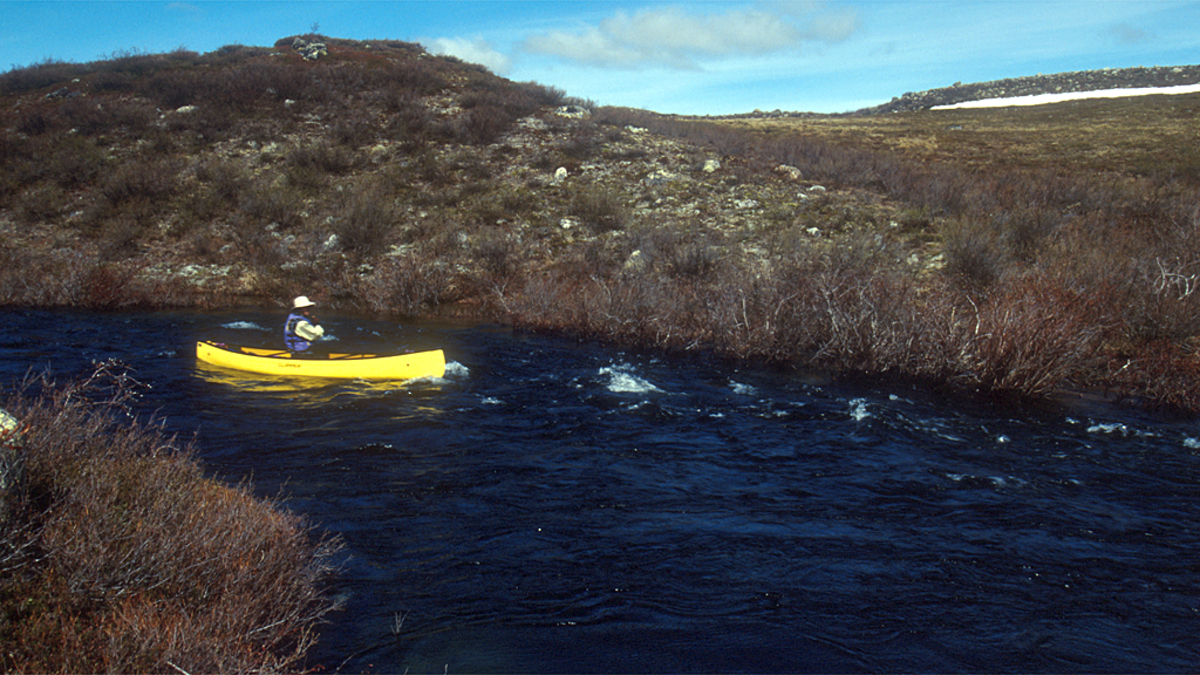
The following day, I began my journey north by paddling a short distance to where the Winter River flows into the lake and did my first of many portages. Each portage meant making three trips to carry all my food and gear to the other end, so, a 1-kilometre portage meant walking five kilometres, three of them with a heavy load.

I would usually carry a big pack with as much stuff strapped to the pack as was manageable and carry one of the camera cases in one hand and my loaded shotgun in the other. I would eat a snack on the return trip with the gun slung over my shoulder. The second trip and the return were a repeat of the first, and on the third trip I would carry the canoe.
Carrying the shotgun became a real hassle and some time on the second day during one of the portages, I began leaving the gun after carrying it on the first or second trip. I did carry a canister of bear spray, though. It was a calculated risk to not carry the gun on every trip but because I was now past the tree line, I could see for long distances and would scan my portage route with binoculars between trips. Most portages were short so I felt safe doing it this way.

Bears have never really scared me but I have great respect for them. Shooting one would be an awful thing to do, and only a very last resort. My worst fear was falling with a heavy load and getting injured.
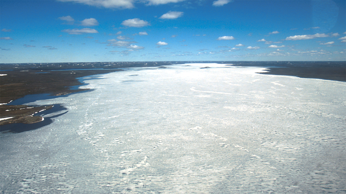
The landscape north of Fort Enterprise is quite flat, scoured by massive glaciers during the last ice age. Dogrib Rock towers over the landscape, although it’s only 60 metres high – a true measure of the flatness of the land. It took me two days of dragging the canoe on the ice, paddling and portaging to reach it. From atop Dogrib Rock, the land and its countless lakes and streams stretched into infinity. I could see Winter Lake to the south and my route ahead to the north.

Life had slowed down dramatically. The simplicity of slowly paddling, portaging and dragging the canoe on frozen lakes sharpened my senses while I was slowly getting more and more absorbed in my surroundings. Throughout the day, I would stop to take notes and make photographs, slowing me down even more.

When I’d had enough or found a particularly nice camp spot, I would make camp, prepare dinner, eat, write in my journal, and read before falling asleep exhausted physically and mentally, only to get up the next day and do it again. I didn’t have much of a time line. As long as I managed to make the food last, I could stay out there until the end of the short Arctic summer.

The days and kilometres ticked by as I slowly made my way upstream on the Winter River to the continental divide at Starvation Lake. Each day blended almost seamlessly into the next as time had lost most of its meaning. The days are 20 hours long and the nights are more like extended twilight.

The evenings were gorgeous as the low angle of the midnight sun bathed everything is soft, golden light. Overhead, skeins of geese carved through the indigo sky, urged north to fertile river deltas to breed and raise the next generation. It was a true privilege to be there alone.
While walking across a frozen lake, I stopped for to have a snack. I walked around the canoe and in an instant I was up to my chest in the icy water. I had failed to notice the deteriorating condition of the ice and stepped on a bad patch. I scrambled out, grabbed the traces and walked a few metres to better ice. It was a warm sunny day so I just carried on as my wet clothes dried out. No damage done but I would have to be more careful.

After 8 days of toiling upstream from Winter Lake, I reached Starvation Lake and the height of land. From now on, I would be descending to the Arctic Ocean, first via the Starvation River to Point Lake and then all the way down the Coppermine River to the hamlet of Kugluktuk.

The final portages had been hard and I was exhausted but celebrated my arrival on the divide with a big dinner and an early night. I awoke to a snow-covered landscape. I couldn’t believe my eyes. I took a photo from inside the tent and went back to sleep, not being able to face winter on the first day of summer. I was roasted out of the tent by the sun a couple of hours later and all the snow had vanished. Had I hallucinated earlier? Had I been alone too long already?
The Starvation River was in full flood. It’s little more than a creek but now, at the summer solstice, it was beyond its banks and flowing quickly. With the rivers in full spring flood now, it would only be a matter of a couple of weeks before the big lakes would begin breaking up.
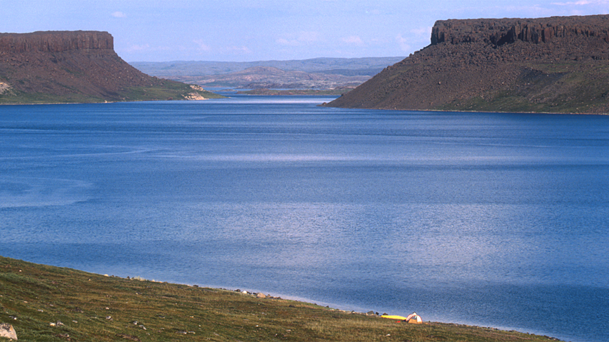
My descent of the Starvation River was quick. There were some big rapids I didn’t dare to paddle and chose to wade and line them instead, sometimes up to my waist in the frigid water. By the end of the day, I was camped on the shore of Point Lake where I faced another problem: how to get through a mess of broken, piled up ice out to open water and on to the solid ice further offshore. But it would have to wait until morning.

I was awakened by the wind and rain. The gorgeous, sunny weather from the previous days replaced by a blustery northwester. The lake near my camp was a mess of broken ice crashing apart on shore, so I hunkered down in the tent reading and sleeping. The wind did finally subside and I decided to try to get somewhere.

I hacked, pushed and barged my way through the candle ice towards open water but some of the larger pieces just wouldn’t budge. My only choice was to get out of the canoe to drag it across. I gingerly stepped out of the canoe. The ice held as I dragged the canoe across. I had nearly made it when the ice suddenly shattered. I floundered in the freezing water, forcing down the fear that threatened to overwhelm me. The ice kept breaking as I tried to get back onto it. I had been in the water for less than a minute but my hands were already numb. The shore was a long way off and it was hard to swim through the candle ice – foot-long shards tinkling like crystal. Beautiful. Deadly.
I had to get into the canoe but after several attempts, I only succeeded in filling it with water and nearly capsizing it. Despite my drysuit, I was getting cold as I clung to the side of the canoe bailing it out. I took a deep breath, kicked as hard as I could and clumsily rolled into the canoe, again filling it partially with water. The fear I had suppressed now gushed out and I sobbed uncontrollably, shaking and gulping for air. My hands hurt. What the hell was I doing here all alone?
With my numb hands I began bailing water from the canoe. Once that was done and the canoe more stable, I tried clapping my hands together but worried they would shatter. I gingerly rubbed them together and after a while some feeling returned giving me enough dexterity to find a wool hat and gloves.
This was madness. I needed to get to solid ice. But how? Nothing but broken candle ice around me. I dug up the walkman from a dry bag and played Miles Davis. With the dulcet tones of Kind of Blue reverberating off the bottom of the canoe I retrieved a pouch of tobacco from the same bag and managed to roll a cigarette, badly. The music and the nicotine helped calm me down and I remembered a passage in Back’s journal in which he describes is as “having received a sound ducking.”
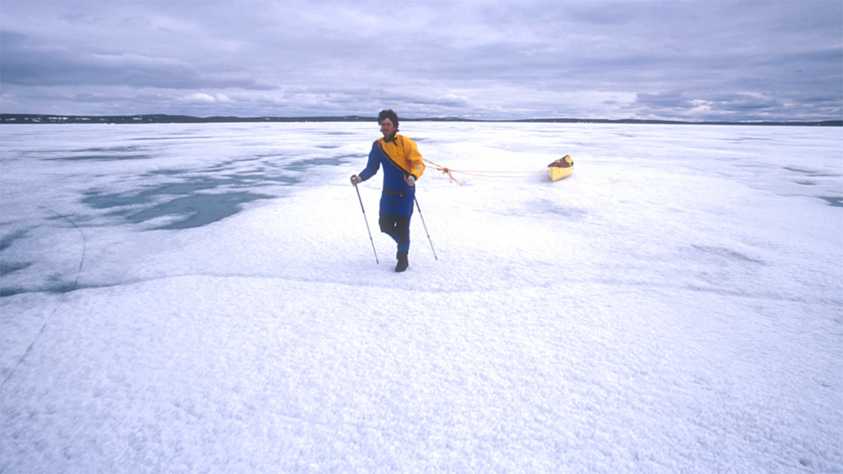
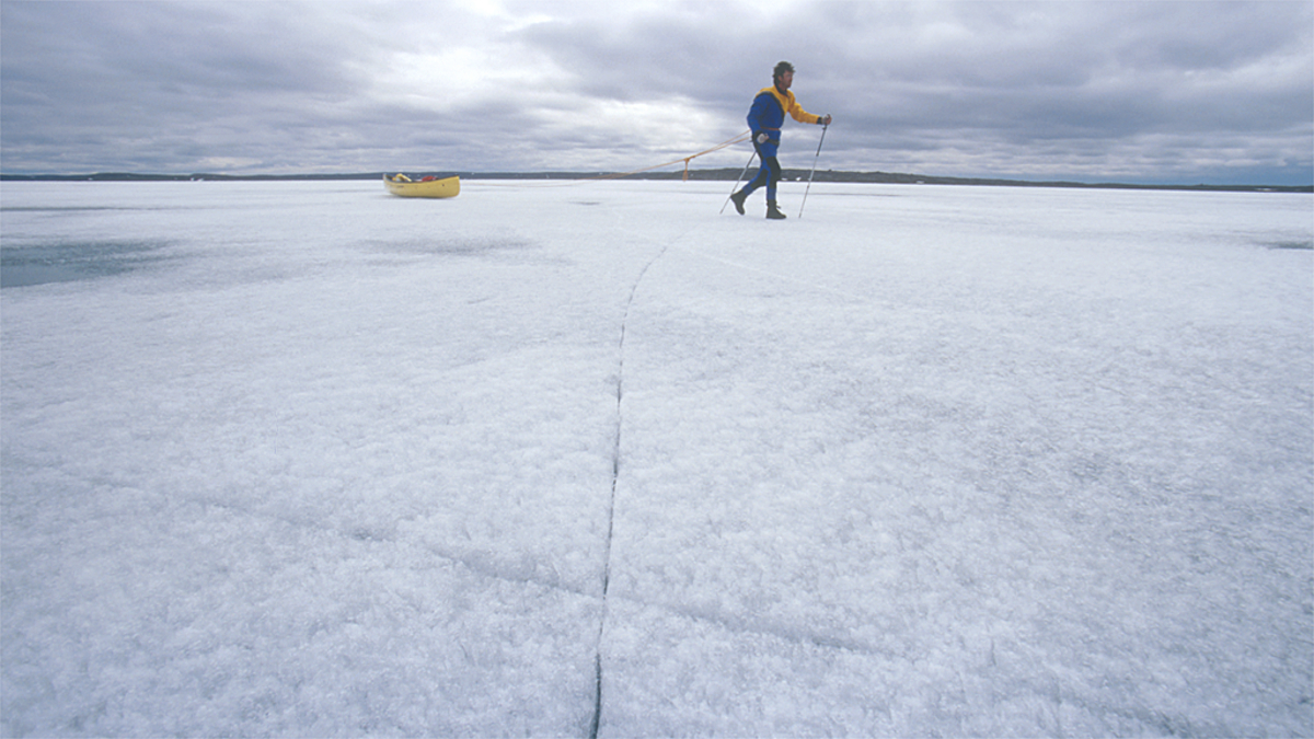
I bashed through broken ice for quite some time until I finally got to a sheet of ice that looked like it would support my weight. I stepped out of the canoe and it held as I walked away from the edge, dragging the canoe up behind me. I dragged my canoe 20 kilometres to a small island where I made camp.
I stood at the edge of my sanctuary in the late evening light and bowed to the river, thanking it. Until my icy baptism, my conversation with the land had been one-sided. I had been cocky and naive but now, humbled by the freezing water, I was ready to learn.
In the morning, I noticed the shore lead had frozen during the night. The new ice looked like feathers and leaves, delicately woven together in an ethereal pattern, reminding me of the ice’s fragility and my dependence on it to get me to the end of Point Lake.

I always looked for strong, white ice, avoiding as much as possible the grey patches that signalled imminent collapse but inadvertently I strayed onto bad ice that bent and creaked with every step when I had an epiphany. I remembered images from my childhood in The Netherlands. Old paintings of pastoral winter scenes in which kids on small sleds pushed themselves along with pointed sticks. In Dutch, they were called ‘prikslee’, or sit sleigh, like the ones used in para ice hockey or sledge hockey.
Well, I had a big sled – the canoe – and a pair of pointed sticks – ski poles – so I sat on my knees in the canoe and used my poles to push the canoe along over bad ice. It worked but required a lot of upper body strength. Eventually, I just stood up in the canoe and was able to use my big leg muscles to achieve the same thing, zooming along in my big, yellow sled. I called it ski-noeing and was able to safely negotiate areas of rotten ice.

One day, trudging along in the hot sun, I stopped for a break and noticed some movement in the distance behind me. A small group of caribou bulls, cautiously walking single file, crossing the ice of the big lake. A closer look on shore revealed other small herds of caribou. All of them bulls as the cows were further north on the calving grounds.


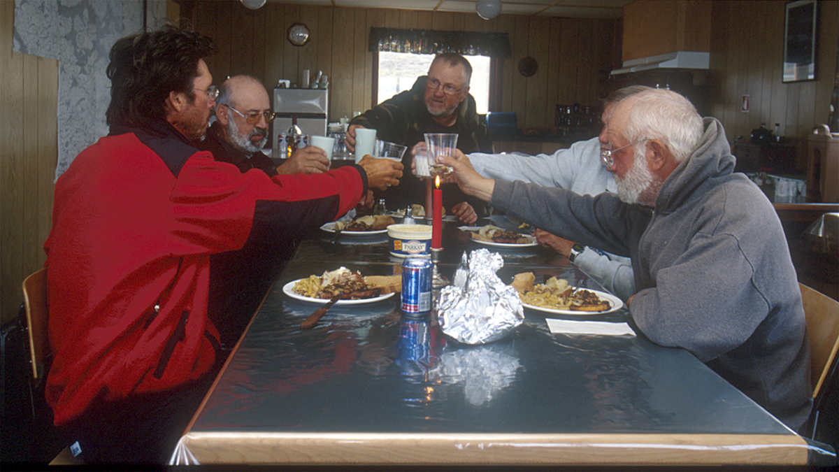
Quite exhausted, I reached Jim Peterson’s fishing lodge at the west end of Point Lake. I had dragged my canoe 120 kilometres in four days. Jim and his friends had seen me coming for a while and greeted me with a bear banger salute. I had been on my own for 15 days and it was great to be among people again. We chatted over hot rum toddies and a delicious meal of roast caribou in the lodge’s dining room.
I spent a couple of days at the lodge, resting and sorting through my gear and food. Ready for the next leg of my journey, I said my farewells to Jim and his crew and continued west on Point Lake. The ice was rapidly deteriorating and before long I was paddling the swift current of the Coppermine River toward Redrock Lake.
On Rocknest Lake, the ice still held fast and I was back to dragging the canoe. Walking along, concentrating on the quality of the ice, I suddenly got the feeling I was not alone. I turned around and saw a wolverine scampering along behind me in that unique gait they have. It paused momentarily and sniffed the air for my scent, turned and galloped away. It’s rare to see wolverine, although I’ve seen quite a few in the north. They’re easier to spot than further south in the forest. They are the largest member of the weasel family and a formidable predator, although they mostly subsist by scavenging.

The river was well beyond its banks and I paddled through the sparse forest in places. The flow in the main channel was intimidating and I was forced to portage a couple of times because of large rapids.
Approaching another large rapid, I realized I was on the wrong side of the river and needed to cross over to the portage. I turned my canoe upstream and began ferrying across, only to find out that I was no match for the current. Paddling frantically while trying to keep the canoe at the right angle to the current it was obvious I would not make it. I paddled as hard as I could but my fate was sealed: I was going down this rapid. I surrendered myself to the mercy of the river and plunged backward over a ledge on a narrow tongue of smooth, black water. Miraculously, I stayed upright and, with a desperate stab of my paddle, pulled myself into the eddy below. Again, I thanked the river and promised to be more careful.
So far, I had only seen one grizzly bear from a safe distance on Little Marten Lake days before. The bear stole a large fish carcass that gulls and ravens had been feeding on. Bears were on my mind often, especially when making camp. Without trees of any size to hang my food supply, the only thing I could do was to stow my food packs under the overturned canoe in camp away from the tent. Not too close but close enough so that if a bear got into it I would hear it and perhaps be able to do something about it. I always kept the loaded gun and bear spray in the tent with me.
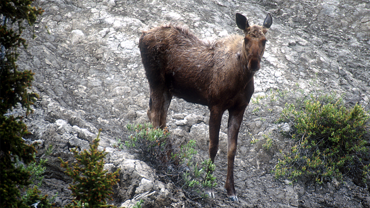
The Coppermine is a large river. I was able to float along and make photographs from the canoe with ease and occasionally sneak up on wildlife, mostly birds: sandhill cranes, red-breasted mergansers, ptarmigan, various gulls, ducks and loons. I saw many bald eagles and peregrine falcons hunting and feeding on the other birds. Besides the wolverine and caribou, the only other mammals I encountered were and moose, mostly cows with calves.

One foggy morning, crossing the Arctic Circle, I floated along with some tundra swans. They were like ghosts around me, their presence only betrayed by their soft cooing – then the explosive flapping of their huge wings and pattering of their feet on the water as they took to the air, having sensed my presence.

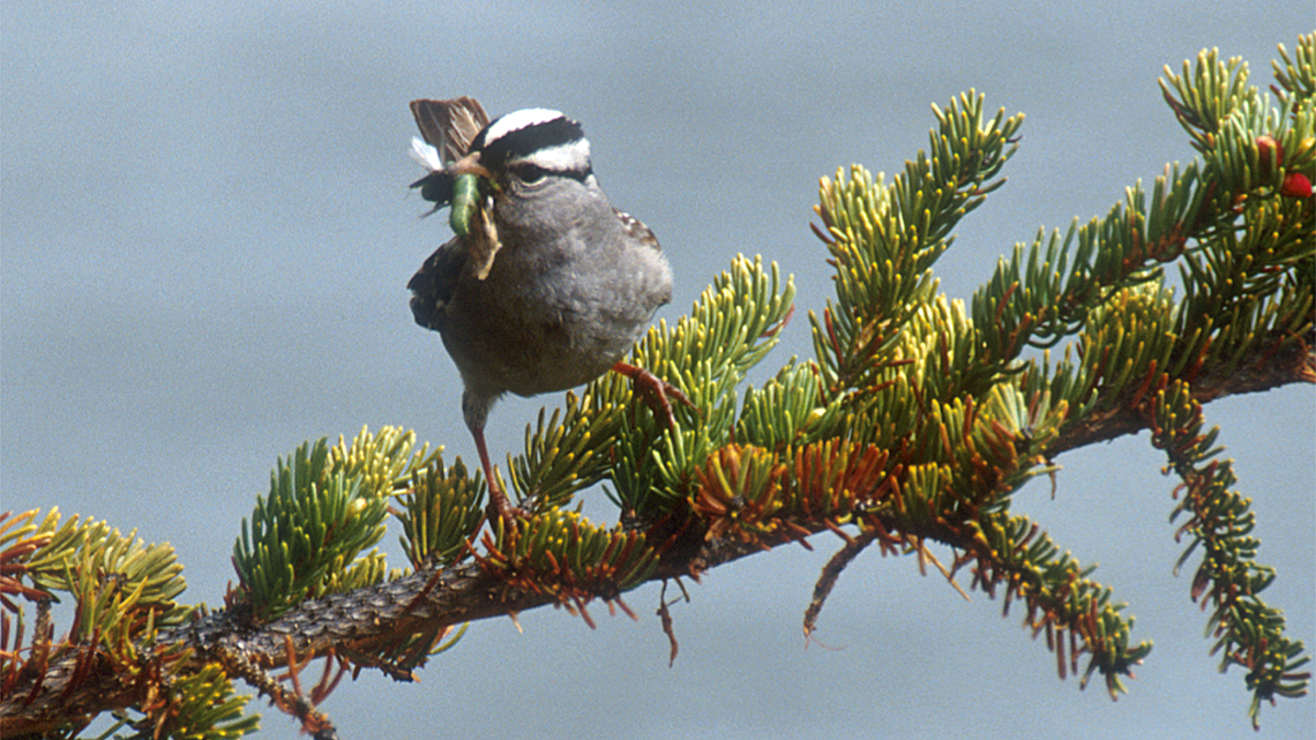
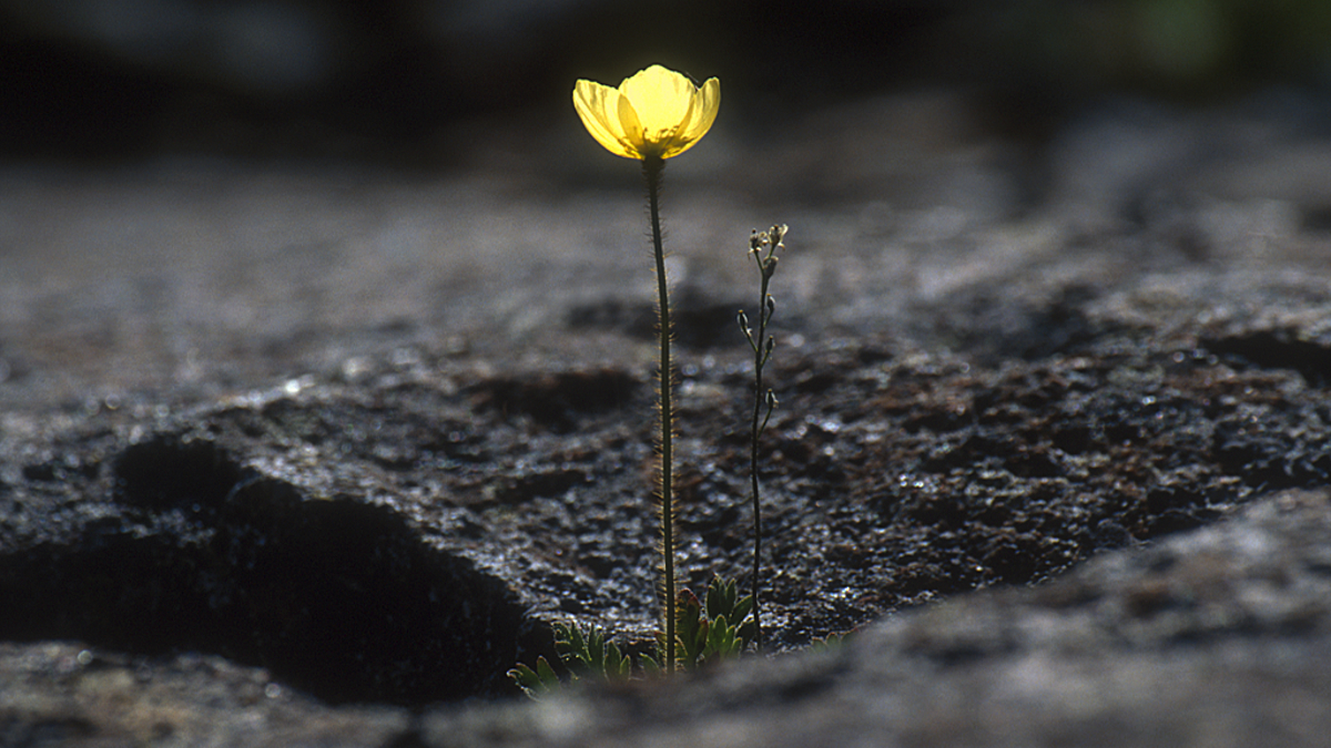
The land teemed with song birds busy gathering food for their growing broods. The melting snow revealed blooming flowers like Arctic dryads, lupine, prickly saxifrage, alpine azalea, moss campion and various louseworts.


Occasionally, I found human signs: old camp sites, dilapidated cabins and a bashed up canoe near the confluence with the White Sandy River. I wondered about the story of that broken hull. Not long after, my isolation ended when I met a group rafting down the river and we spent two days together, arriving at Rocky Defile.

With a copy of Back’s painting of Rocky Defile, I climbed the steep portage trail in search of what his view point had been when he made this beautiful painting and I was amazed at how little had changed in nearly two centuries. Back described it “…as the most extraordinary [rapid] we had yet see. [It] formed a most imposing scene which may be equalled but seldom surpassed.”

In the morning, as the raft crew finished their breakfast of pancakes and bacon, I shouldered my first heavy load across the portage and hiked back along the canyon’s rim where I found a memorial for Bob and Carol Jones who drowned in the rapid in 1972. Despite this sobering reminder, I chose to run the rapid with a lightened canoe. The rafters went first and agreed to wait for me at the bottom.

As they disappeared from view, I pushed off and let the current take me, feeling like a cork in a maelstrom. Slipping into the canyon, I hugged the inside bend and as I turned the corner a deafening roar hit me. Ahead, on river-right the water bounced off the rock wall, pushing big diagonal waves towards centre. I angled the canoe through a gap only to have to avoid a series of huge standing waves. I narrowly missed the first wave and rolled beautifully over the second one, put in a couple of hard strokes to avoid the next waves and shot out of the rapid.

It was amazing to feel that awesome power of the river and I thanked her for the experience. I promised to never do it again. I still don’t know why I chose to run that rapid. Had the rafters not been there, I would not have even considered running it. Perhaps their presence gave me a false sense of safety in numbers. I don’t know.
At the Kendall River confluence, I thanked the rafters for their companionship and pushed on alone. The shores were littered with huge ice blocks, sculpted by the elements. The ice was left on shore during the break-up of the river. I laid back in the canoe, lazily floating along and admiring nature’s handiwork when I heard voices. Two guys were fly fishing from shore so I paddled over to say hello.

Faruk and Bill told me later they thought my canoe was empty and wondered if an accident had happened to the paddler. They invited me to stay for dinner. So much for going solo. Never in my wildest dreams had I imagined sitting on the banks of the Coppermine River sipping wine and eating a fresh fish dinner with new friends. Faruk told me he had flown into this spot every summer for the last 10 years to spend a couple of weeks fishing and hiking before floating down to Kugluktuk in a small raft. He gave me valuable information about the rapids ahead.

The Coppermine now flowed visibly downhill and for 25 kilometres, from Sandstone Rapid to Escape Rapid, the river is class II and III whitewater, funnelled through successive canyons. I had long hours of practice, scouting ahead from wave tops and back-ferrying to stay in the inside bends.


My days on the river were waning so I lingered at Escape Rapids before moving on to Bloody Fall. It was named by Franklin for the 1771 massacre of a group of Inuit by the Chipewyan who had agreed to accompany Samuel Hearne, the first European to explore the region. Below the fall, the Coppermine lazily meanders its final kilometres to the Arctic Ocean and the hamlet of Kugluktuk.

I had been travelling for 39 days when I paddled into Kugluktuk. It was a shock to hear the noise of outboard motors. I contemplated going home: the ocean scares me. I could see pack ice off shore and worried the wind would blow it back in. But after cleaning up and collecting my resupply of food from the post office, I climbed the hill behind town to watch the midnight sun skim the northern horizon. It was time to face my fear.


The weather was hot and the mosquitoes were biblical. To avoid them I paddled far offshore. When in camp, the bugs forced me to retreat to the tent to cook, read and sleep. After a couple of days, it became clear that ice would not be a problem – but wind was. When it was too windy to paddle, I explored my surroundings or dozed in fields of lupine, lying down among the fragrant flowers.

Coronation Gulf run east to Bathurst Inlet between the mainland and Victoria Island. Razorbacked cliffs rise dramatically out of the ocean. It’s a spectacularly wild place: rugged, desolate and without obvious human incursion.
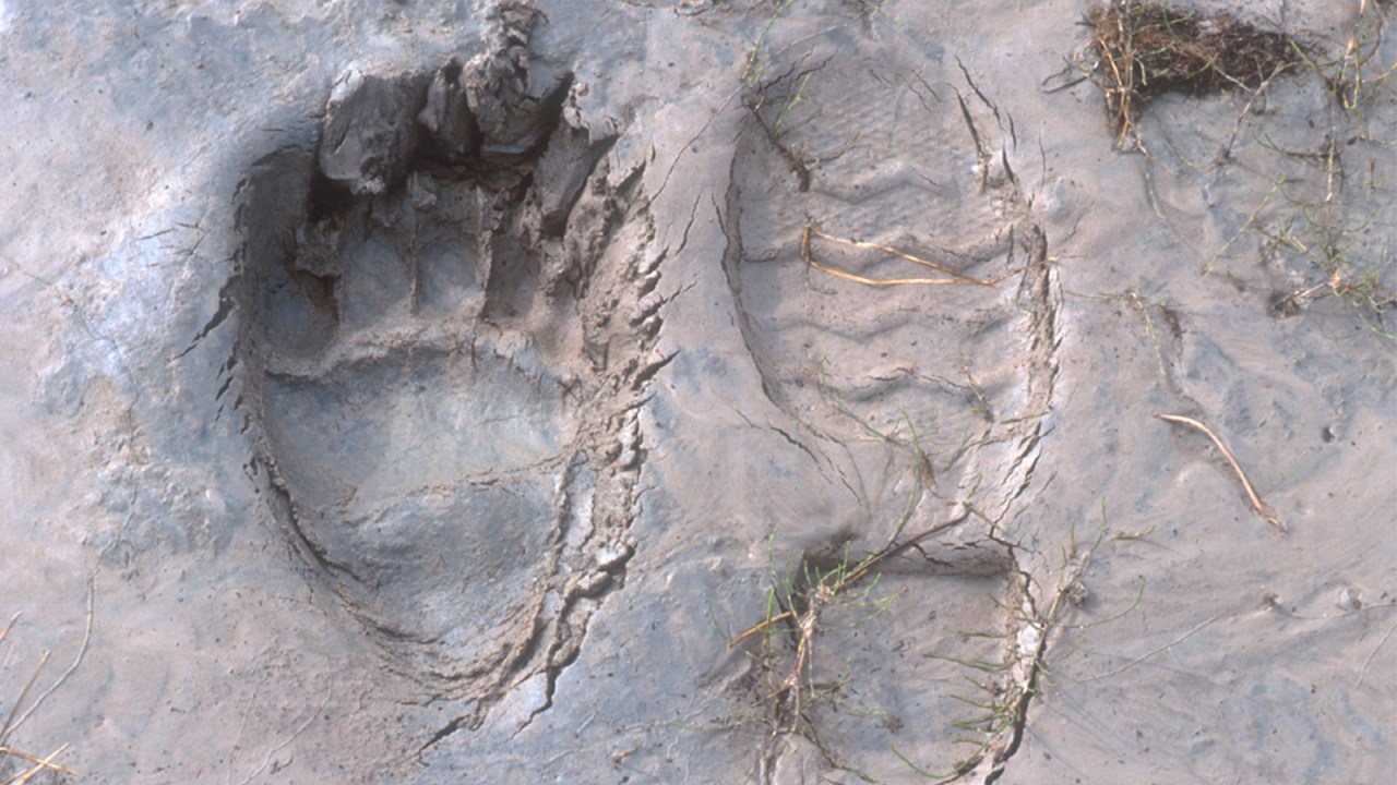
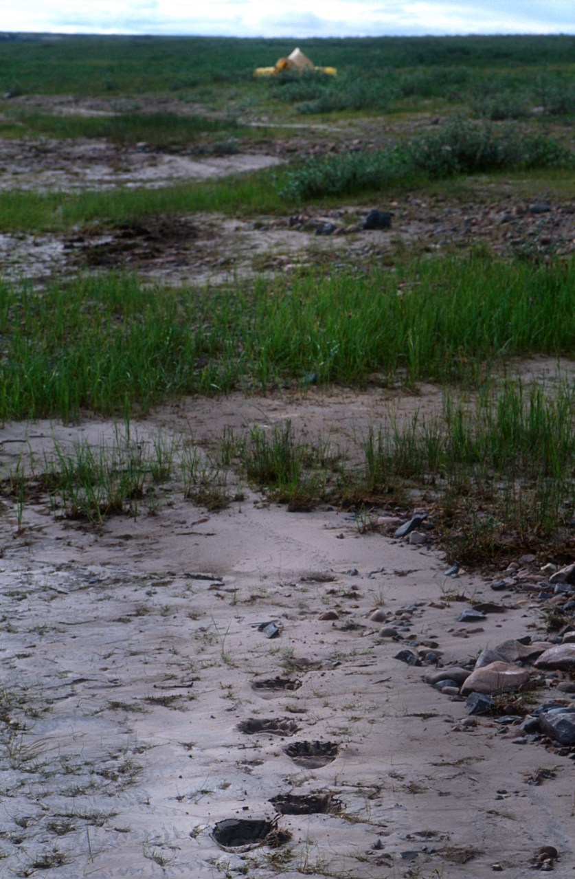
One morning fresh grizzly tracks surrounded my camp. I touched the deep impressions and thanked the bear for leaving me alone. I had been lucky but the paw prints magnified my feelings of vulnerability.
For hours I hiked the beaches and cliff tops, thinking about the Inuit who have inhabited this land for generations. Here and there I would find evidence of their passing: food caches, fox traps, tent circles and old grave sites. Their passage through this land made me more at ease while at the same time fresh grizzly signs reminded me I was a mere visitor here.


The wind repeatedly toyed with me. One day, about a week out from Kugluktuk, I was floating on a sea of glass about a kilometre offshore. I pulled out the stove and made a cup of tea to have with a snack. A slight riffle appeared on the water and within mere minutes, the surf was up and paddled for my life to get to shore. The change had been very sudden and was a reminder to always stay alert.

I had the luxury of time and decided to wait for perfect conditions to round Cape Barrow into Bathurst Inlet and my patience paid off. The ocean turned into a mirror and I paddled around the cape with ease, camping on a small island in Detention Harbour where ice and bad weather had held Franklin’s party captive for three days. As I watched ocean and sky melt together in indescribable blues, I stretched out on the warm, pink rocks thinking about how lucky I was.
But my luck changed during the night as a storm blew in. The weather was so miserable, I only ventured out of the tent for absolute necessities. I didn’t even go out for water. Instead, I just put my pots outside to collect rain water. Toward the end of day two, I had read all my books. By day three, I was depressed.
When the weather finally cleared, I was determined not to get stranded again and paddled 46 kilometres. Along the way, I made a risky 12-kilometre crossing of Daniel Moore Bay. Exhausted, I camped at Kater Point at the head of Arctic Sound and the next day paddled the remaining 38 kilometres to the Hood River estuary.

I had planned to go 40 kilometres upstream to Wilberforce Falls, the highest waterfall in the Arctic. It was day 55 and I was tired. Those three days of confinement at Detention Harbour had broken my spirit. I had lost my enthusiasm. I wandered around in the twilight, asking questions in my continuing conversation with the land.
By morning, I had a clear answer. As clear as the deep paw prints in the mud near my tent. While I was asleep, another grizzly had wandered into camp and I did not feel safe any longer. Remembering the promise I had made myself eight weeks before, I acknowledged it was time to go home. I sent a message to my expeditor in Yellowknife to come and fetch me.
I spent the next two days writing and packing equipment while waiting for a plane when a party of canoeists appeared. This group of seven had paddled the length of the Hood River and, like me, was scheduled to be picked up the next day. Some of them I had met before and were friends of friends. Small world. That night we celebrated our trips, trading stories under a rising full moon.

For two months, I’d had a conversation with the land and learned many things about my own fears and insecurities, but also my abilities and learned to cope with stress. The journey also taught me that to be human is to want and need the company of others – though not necessarily all the time. I had never really consciously known that until then. Spending my last night with fellow adventurers seemed a fitting end to this journey.


Outstanding, as always. Stay safe!
Thank you, Norman. Hope you’re well.
Hi Paul
I remember a lot of your story from your slide show – just as well as virtually no photos loaded in this post.
I, too, am no stranger to isolation! 7 weeks was the longest I stayed with no human contact – or communication.
Hi Chris, I hope that the photos not loading is an issue on your end and not my web site. It’s loading very well here.
Hope you’re well in your isolation in the Chilcotin. Might come out that way this summer as we’re staying close to home.
Thank you for this impressive, honest story about that heavy experience.It is written beautifully and deserves to be extended to a book, may be together with a psychologist for some reflection about your emotional etc. experiences and reasons for the choices you did make, your fears and so on. Thank you.Jaap Doolaard
Thanks, Uncle. Groetjes aan iedereen.
Beautiful photos and thoughts. Brought back memories of my own, much less ambitious solo trips on the same route, also inspired by Hood’s watercolours and Back’s and Franklin’s journals. I flew in to a point on the tundra just by the Coppermine and paddled back to Winter lake, just before freeze-up 1978. Another time–with friends– I flew into Winter Lake and paddled back to Yellowknife. Another time I took a motorized canoe up the Snare River from Rae Lakes almost to Winter Lake. Another time…well, you get the picture. Thanks for the memories!
That was really fascinating Paul. I felt like I was there with you at times! Thanks for sharing your writings. Take care and stay healthy!
Thanks, Ray. You, too, stay healthy. One of these days I’ll see Rafe again 🙂
I just read this! I am absolutely amazed of your mental and physical strength in coping with all the different elements you encountered. Thank you for sharing your story.