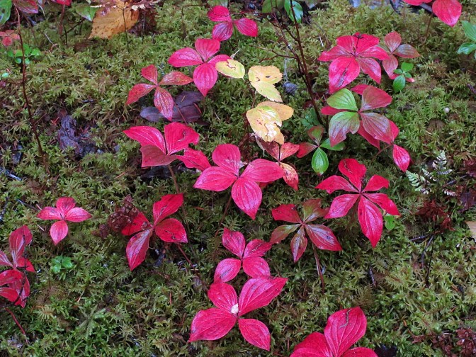
Fall is one of my favourite times of year to be in the back country. It’s a time of change. The rush to buckle down for winter is on, especially in northern British Columbia. The Bowron Lakes is a world-famous canoe circuit paddled by several thousand people every year but in late fall, there is hardly anybody around. Snow blankets the surrounding peaks. Bears are in the valley feeding on berries and salmon, rapidly putting on the weight they will need to survive the winter. Moose are getting in the mood to rut and most of the birds and waterfowl have already headed south to escape the cold.
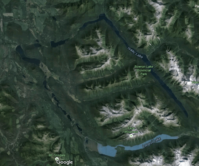
The Bowron Lakes circuit is encompassed in a provincial park on the western slopes of the Cariboo Mountains, part of the Columbia Mountain Range. The 116-kilometre-long circuit is a series of lakes connected by rivers and portages in a rough parallelogram shape. There are no roads and no services. There are camp sites and a few primitive log cabins and shelters. You are on your own in this wild country.
I’ve been here many times at different times of the year but it never gets old. It’s familiar but never the same. The weather can be gorgeous but it can also be brutal, as it was on our first day.
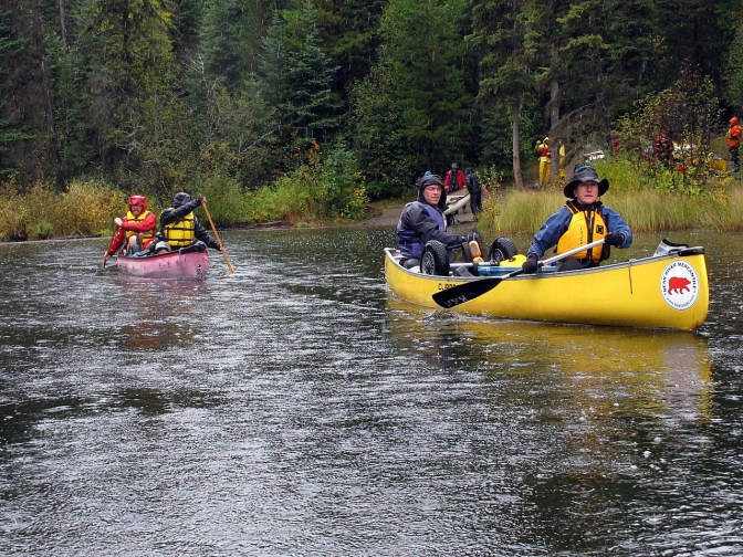
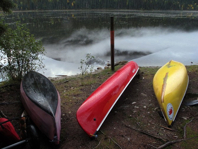
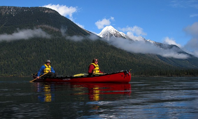
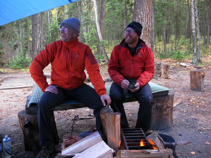
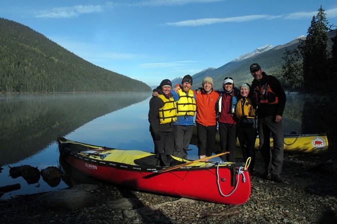
Jan and I were joined by our friends Joanne, from Vancouver, Holger, who spends his time between Cairo and Boston, and the Els, currently homeless cyclists but hailing from The Netherlands. After registering and watching the mandatory safety video, we were ready to go, standing in the pouring rain in the parking lot at the beginning of the first portage trail, and our friends were probably wondering what the hell we were doing here, but nobody said anything and everybody was smiling.
It’s a 2.4-kilometre uphill push to Kibbee Lake, a small, shallow lake that is the first of 11 lakes in the chain. The weather is miserable. We are already wet. The goretex just isn’t really up to the task. Don’t believe the claims made by the manufacturers. They’re all lies.

There are two other groups starting the circuit today but we are quickly on our own in this beautiful, wild place. There is a cabin on Kibbee Lake but we choose to move on and do the next portage into Indianpoint Lake, another 2-kilometre walk with canoes.
By the time we get to the put-in, the weather has closed in even more and we are soaked from the rain and sweat. Portaging is hard work, even though we have our canoes loaded on carts. I put on another layer under my wet coat to keep warm as we push off into the liquid grey of Indianpoint Lake.

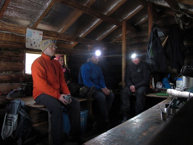
An hour later, we stumble into the small cabin on the north shore of the lake. It’s dry but there is no firewood around, however, the place warms up quickly with six bodies inside and the stove going as we make soup and a pot of coffee. We doff the wet gear and slowly some level of comfort returns. We are having a little adventure. Some adversity and discomfort is mandatory on a trip like this.
There is not much space for tents but we manage to get three of them set up. Jan and I will sleep with the mice in the cabin. While we busy ourselves with camp chores, the rain stops and we spot a bull moose on the opposite shore. In the water are two more, a cow and calf. The trio swim further into the lake towards us. The bull seems to be trying to separate the cow and calf but he’s not having much luck. Perhaps he has amorous inclinations. His huge antlers are still blood-red from having recently shed the velvet from them. The three of them keep swimming in circles in the middle of the lake until four chatty guys in two canoes scare them back to the far side of the lake. (see Ellen’s photo)
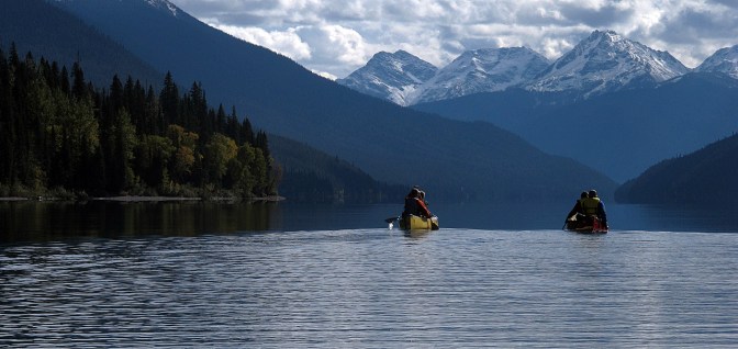
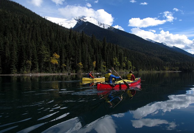
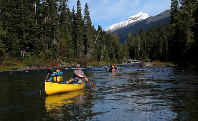
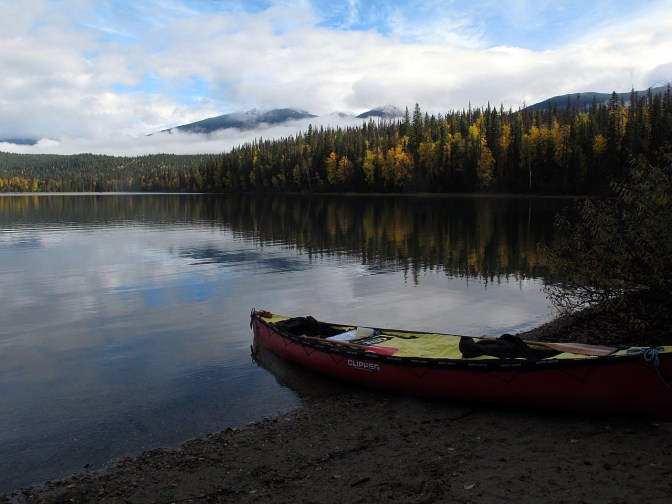
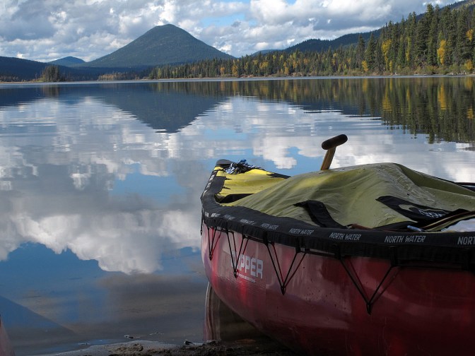
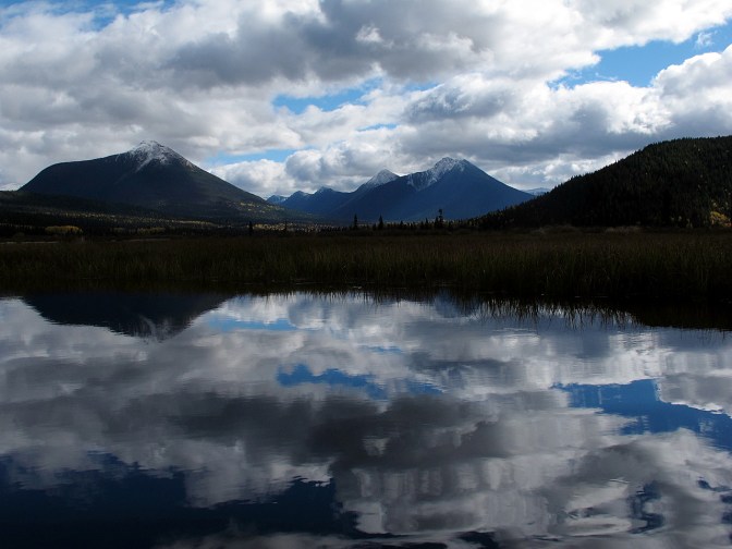
The rain continues to fall through the night but by morning, things are looking up. We paddle the remaining kilometre to the east end of Indianpoint Lake and portage our canoes one and a half kilometres to Isaac Lake. By the time we get there, the sun is shining and the sky is clearing. We paddle into Wolverine Bay as the mountain tops reveal themselves, covered with fresh snow. We will spend 2 days paddling Isaac’s 38 KM length. It’s the longest in the chain and we’re looking forward to not having to portage for a couple of days.

After lunch, the wind kicks up a bit while we cross Wolverine Bay to the eastern shore of Isaac Lake. As we near Moxley Creek, we are paddling into a stiff head wind and decide to call it a day, even though we’ve paddled only about one quarter of the lake, but it makes little sense to fight the wind. Besides, there is a small cabin at Moxley Creek and enough fire wood to get the wood stove going. It will make a very cosy home. We erect our wet tents and hang damp sleeping bags. With the wind and sun, everything dries quickly while our wet clothing dries by the fire inside the cabin.

Even though the skies cleared completely during the afternoon and evening, the rain returns with a vengeance that night. It pours for hours. But by morning it’s dry and the sun again graces us with her warmth and light.


The day continues to improve as we head down Isaac Lake. We soak up the sun and the spectacular views of the surrounding peaks of the Cariboo range, rising up to 2,300 metres (7,500 feet). The rest of the day we silently glide on the mirror-like surface of the lake, arriving at the south end by mid-afternoon. We make camp at The Chute, a small rapid where Isaac Lake drops into the Isaac River.
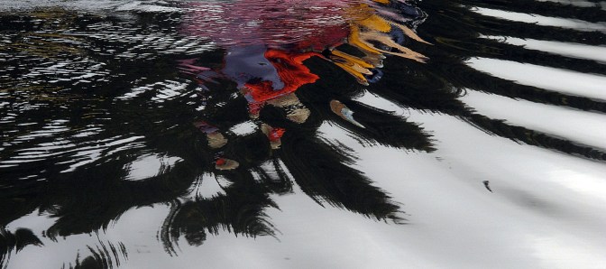
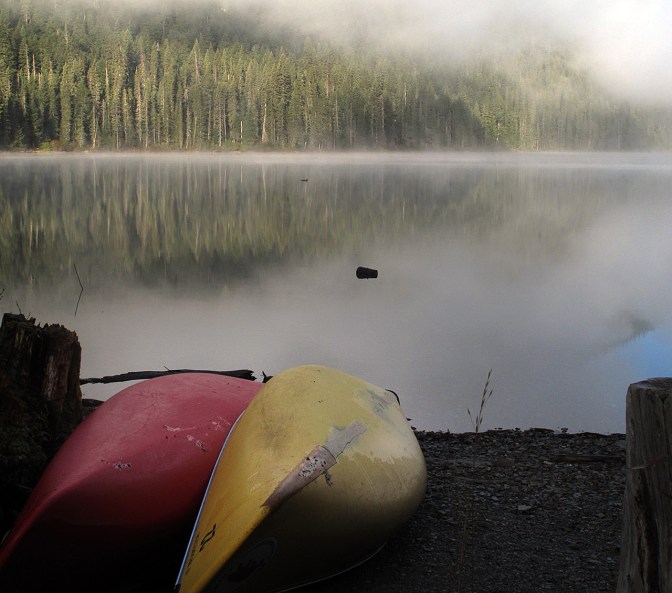
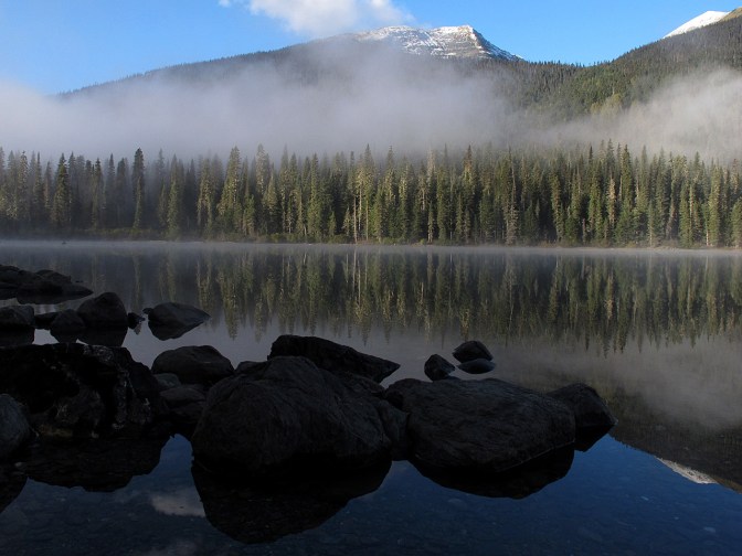
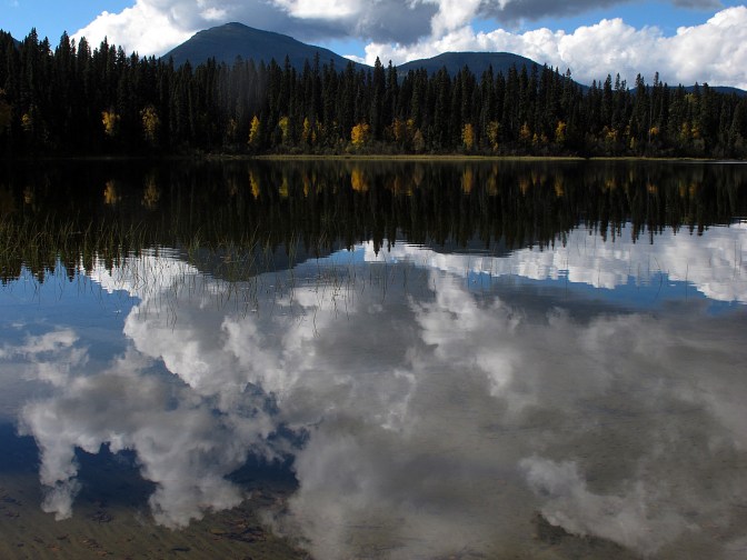
The morning dawns in a dense blanket of fog but as the sun rises the fog lifts, promising another gorgeous day ahead. We sip coffee and make photographs by the lake shore of the perfect reflections.


After breakfast of bacon and eggs we break camp and prepare to run the Isaac River. Jan and I descend The Chute first, taking up position in a back eddy to photograph the others run the rapid in quick succession before we head down the Isaac River where the fog still clings to the trees.


We run about a mile of river before we have to pull out above the unnavigable Cascades and portage a short distance. We run another section of river and haul out above a waterfall where the river drops 11 metres (34 feet). The portage doesn’t take long and afterwards we linger in the sun on a gravel bar where the Isaac River flows into McLeary Lake.

McLeary is a shallow pond created by the merging flows of the Isaac and Cariboo Rivers. The clear water of the Isaac River is quickly overwhelmed by the much larger, silty Cariboo River, a slow, meandering Fraser River tributary that has its origins in the Cariboo Mountains’ ice fields to the southeast.
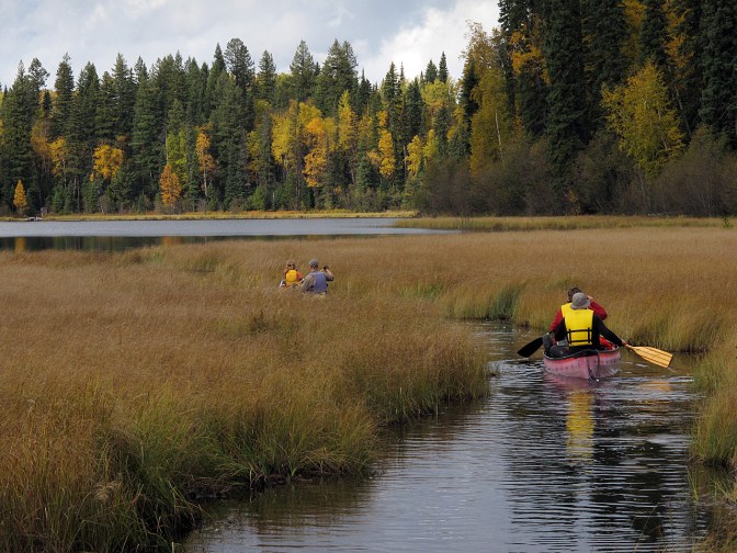
It’s great to be on the river. The current pushes us along and all we have to do is keep away from sweepers: trees fallen from shore into the river; and dead heads: submerged trees and logs stuck in the muddy bottom. As long as one stays in the middle of the river and keeps an eye out for tell-tale ripples on the surface, safe passage is easily negotiated.

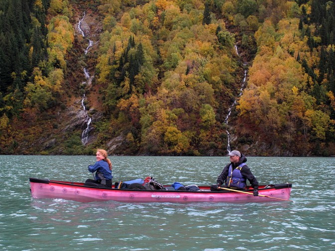
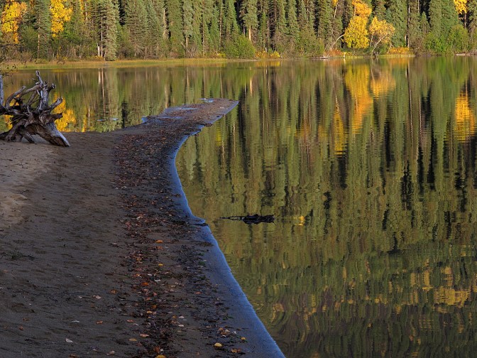
We haul out on a gravel bar to have lunch and enjoy the fall scenery. Aspen trees are a golden, nearly translucent partition in front of the snow-clad peaks along Lanezi Lake ahead to the west. It’s gorgeous and we linger in the warm sun.

Our luck continues as we enter Lanezi Lake. This turquoise lake is often whipped up by a west wind creating steep waves against the current in the shallows where the Cariboo River runs into the lake. It’s like glass and we lazily paddle out into the lake. An hour later, we land at the Turner Creek camp site where we decide to take advantage of the cooking shelter and make camp.

We light a fire in the stove and the place heats up quickly as we make dinner and sip our wine, enjoying our time together. Clouds and rain move in during the evening but we are warm and dry, so, never mind.

We’re greeted by a grey, gloomy morning but it’s not raining. We head out after breakfast in windless conditions and watch the scenery go by as we slowly paddle west along Lanezi. The mountains here are steep and avalanche chutes run all the way down to the lake shore. It must be quite an active place in winter. I hope to ski around the circuit one winter. I tried 15 years ago but a heavy snowfall in March discouraged me.
The Cariboo River reasserts itself briefly before widening again into the bath tub shape of Sandy Lake, a shallow depression with sandy beaches that narrows again into the Cariboo River as it carves its way west before making a sharp turn to the south and over 24-metre-high (80 feet) Cariboo Falls.
Just before the Cariboo River’s plunge over the falls, there is the narrow entrance to Unna Lake on the left shore. Unna is a little gem of a lake. It’s a small pond ringed by a forest of pine and aspen, creating a green and golden fringe with the Cariboo Mountain peaks rising above in the distance.
We make camp and set up a tarp to have some shelter from the impending rain. There is a good supply of firewood so Elmar gets right down to business and gets a fire going while I set up the table we found, forgotten by a preceding party of travellers at one of the Isaac River portages. It seemed a shame to leave it and it makes a handy kitchen. It pisses rain all afternoon and into the night.

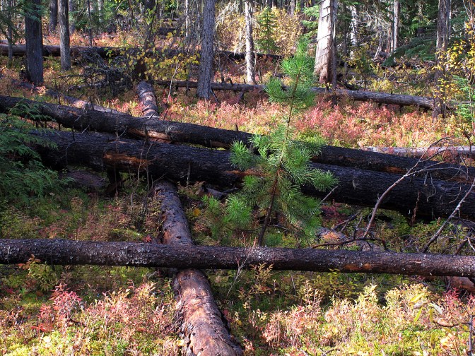
In the morning, we paddle our loaded canoes across the lake to the trail head leading to Cariboo Falls. The red leaves of the blue berry bushes cover the ground in the open pine forest. It’s a good berry year but we only pick a few to have a taste, leaving them for the bears who need them more than we do. There is a lot of deadfall. The result of a pine beetle infestation that’s plagued the province for a long time, turning huge tracts of green pine forest first to brown and then to grey as the forest dies off.
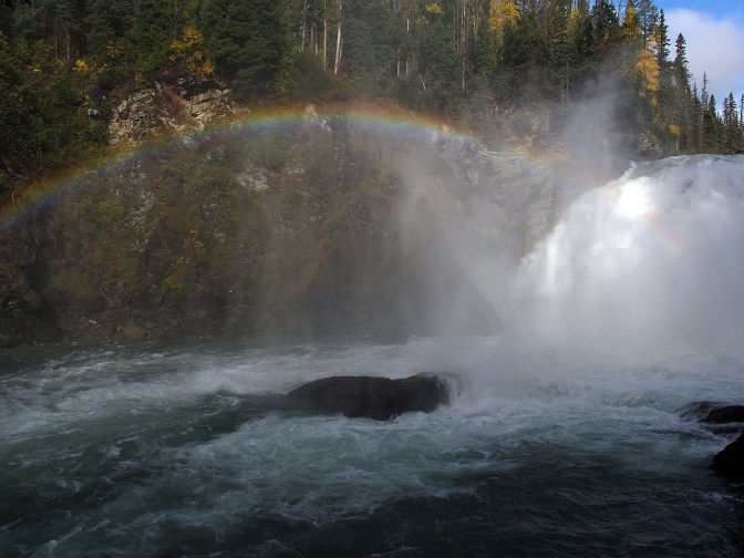
Cariboo Falls is impressive. Water levels are higher than I’ve seen them before at this time of year and the roar is deafening. A rainbow hangs in the canyon below the falls as the river carves its wa south. Every time I come here I have the urge to drag my canoe and gear into the canyon to continue on the river below the falls. I’ve stared at the map many times. I think I may have to do this.
We return to our canoes and paddle the short distance back up the river to where Babcock Creek flows into it. Here, we portage about a kilometre into Babcock Lake. We have another short portage at the north end of Babcock to tiny Skoi Lake, and the final 400-metre carry into Spectacle Lakes. The sun continues to shine and we glide up to Pat Point, a sandy spit separating Swan and Spectacle Lakes. Again, there is a small cabin we have at our disposal with a wood stove. With the fire going, the cabin quickly warms up and we call it home for the night.


We drink the last of our wine and whiskey and play a game of Qwirkle, a game resembling dominoes that Holger has brought. We eat, drink, play and laugh. It’s our last night on the circuit and we stay up later than our usual 8 p.m. bed time. A nearly full moon rises over the Quesnel Highlands and we go outside to have a look. The full lunar eclipse will be in two days. Unfortunately, we will have to see it from the city instead of here.

Our luck holds out as the next day dawns sunny and without wind. We linger over a breakfast of pancakes not really wanting the trip to end yet. Eventually, we break camp and load the canoes one more time.

Swan Lake is a mirror. We see many geese and ducks, the final stragglers who haven’t yet headed south. The lake narrows at the north end and flows into the Bowron River where sockeye salmon have deposited their fertilized eggs in the gravel after swimming all the way upstream from the Pacific Ocean at Vancouver to the upper Fraser River before turning into the Bowron River, a journey of nearly 1,500 KM. I wonder if it was a good salmon run this year, and if it has provided enough food for the bears.

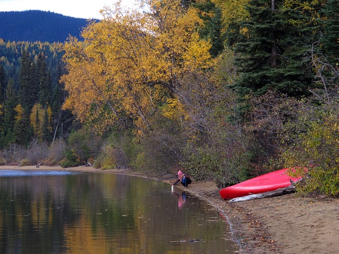
The final kilometres of our journey take us down Bowron Lake back to the Bear River Mercantile camp site where we began our journey a week earlier. We unload the canoes, clean and dry the gear as much as possible before loading everything and everybody into the truck, including Ellen and Elmar and their bicycles, for the ride to Quesnel where we spend our final night celebrating with a steak dinner. Another great adventure.

You guys ARE the bestest. The pictures are fabulous. The story as well. Wished I was there. Another fabulous trip.
The sock is not running in Balaton lake.
Thank you for keeping me in your contact file. I enjoy your posts very much. Love Auntie Carol
Amazing pictures!! Godsmaching or gobsmaching or gobsmacking o uauuuuu also works! We want to settle there and being able to do that kind of week with you guys!! We miss you. If the bike makes big asses maybe the kayack mades big breasts … I should change sport! Muchos besos y abrazos para Paul y Jan! By the way we spend the week end in Ibiza…the nightmare island of outdoor people.
So great to hear from you guys. I just saw this now 🙂 It would be great to connect by skype one of these days. We miss you too. Come over for a visit soon! xo