I sit watching a damp drab envelop the city of Vancouver with some excitement because it means it’s finally snowing in the mountains – very late this season. My mind drifts back to late summer when Jan and I were joined by our friends Alba and Gérard from Barcelona on a Yukon multi-sport adventure. I posted some images from this journey on Instagram but have neglected to post anything here. So, as I wait for the snow pack to build up a bit more, I’ll work on correcting that neglect.
We met at the end of July in Whitehorse at the home of Warm Showers hosts Katie and Olivier and their young children, Lily and Atlas. They hosted us in 2016 when Jan and I spent a month in the Yukon paddling and cycling, and they generously offered to host us again. It was great to reconnect and spend a few days in their bustling household with a delightful Lily, who was born just after our previous visit, and a spirited 8-month-old Atlas.

The plan was to paddle the Teslin and Yukon Rivers, from Johnson’s Crossing to Dawson City, and then cycle north on the Dempster Highway from Dawson to Inuvik or, if time allowed, all the way to Tuktoyaktuk on the one-year-old extension of the Dempster.
Alba and Gérard have never spent any time in a canoe before, so this was a bit of a dive into the deep end for them: 700 km of wilderness paddling with the need to be self-sufficient.
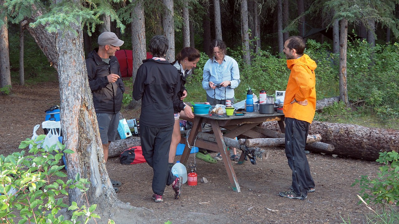
We rented canoes and organized a shuttle to Johnson Crossing with Up North Adventures in White Horse. We purchased and packed most of our food in Whitehorse, counting on a resupply for certain things at the store in Carmacks, the halfway point of the journey to Dawson City, and the only resupply point on the route.
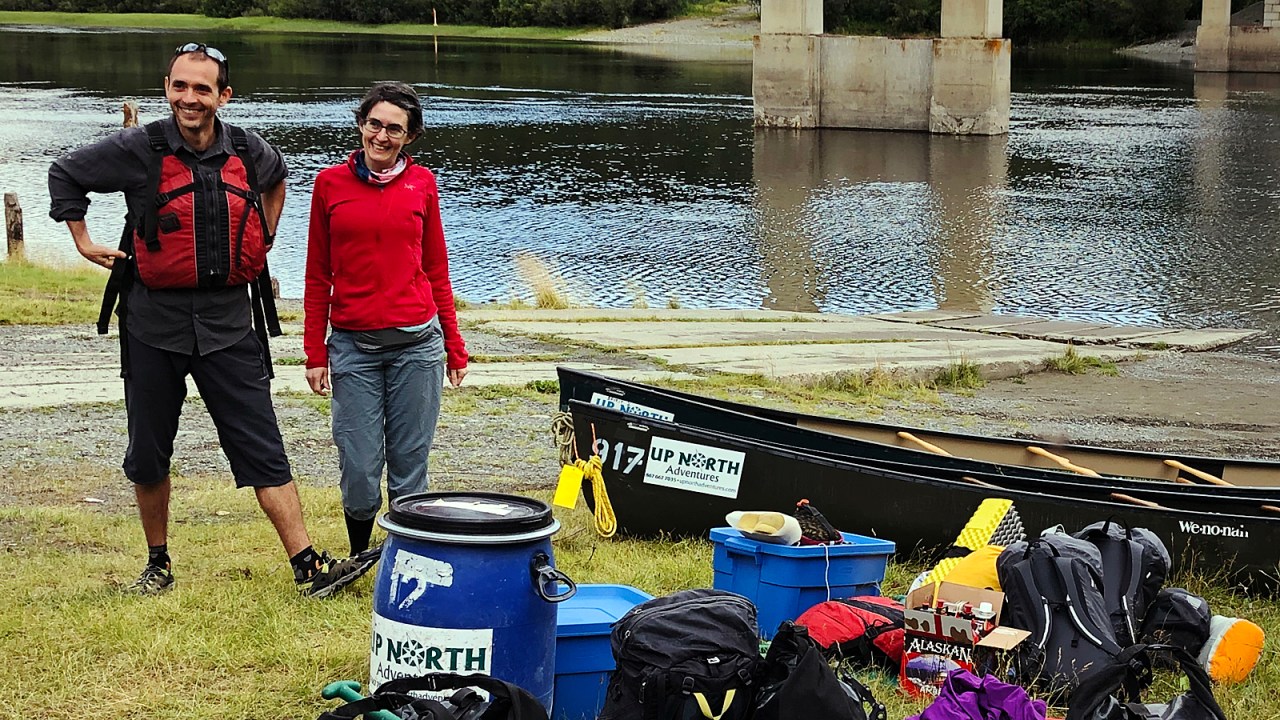
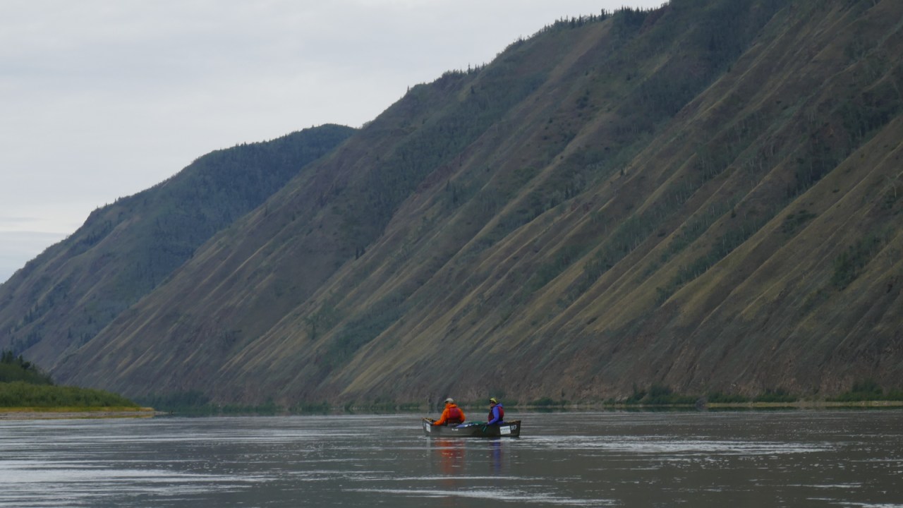
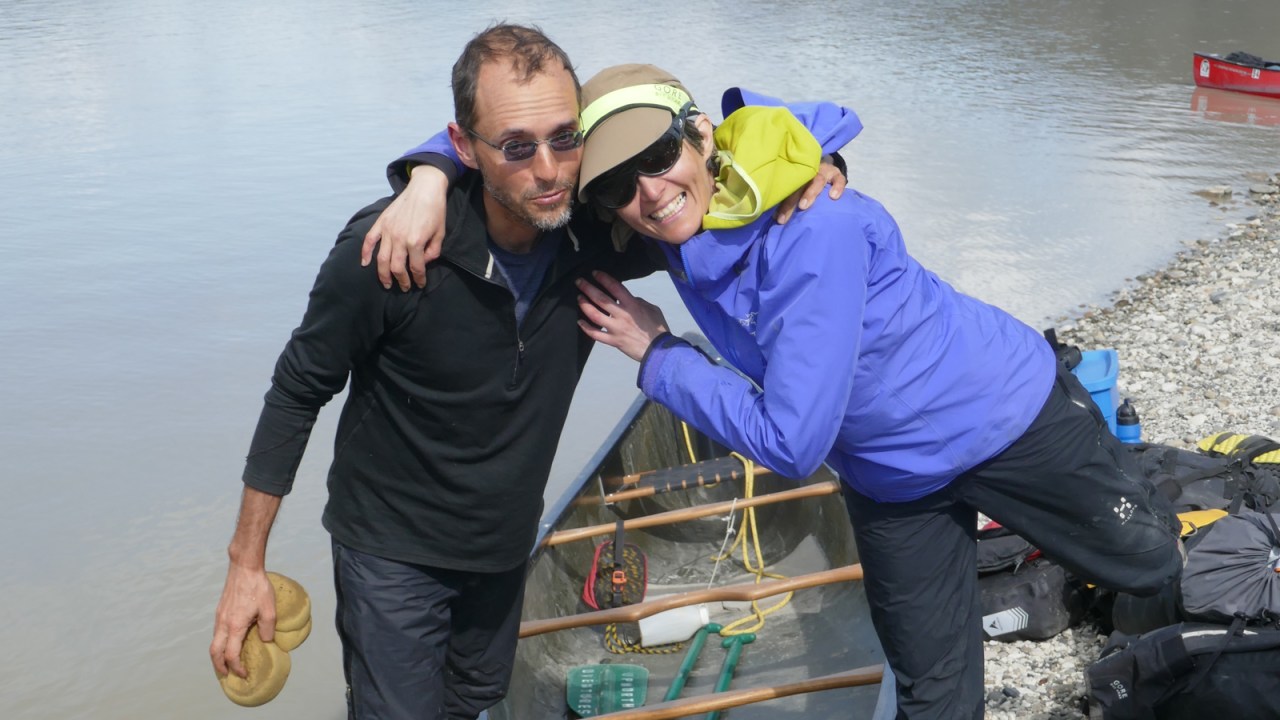
The journey begins with a short tutorial in canoeing basics on the shores of the Teslin River below the bridge at Johnson’s Crossing. We deliberately chose this route to Dawson to avoid Lake Laberge, a 50-kilometre-long widening of the Yukon River that can be a tempestuous cauldron when it’s windy. Not something for novice paddlers to deal with.
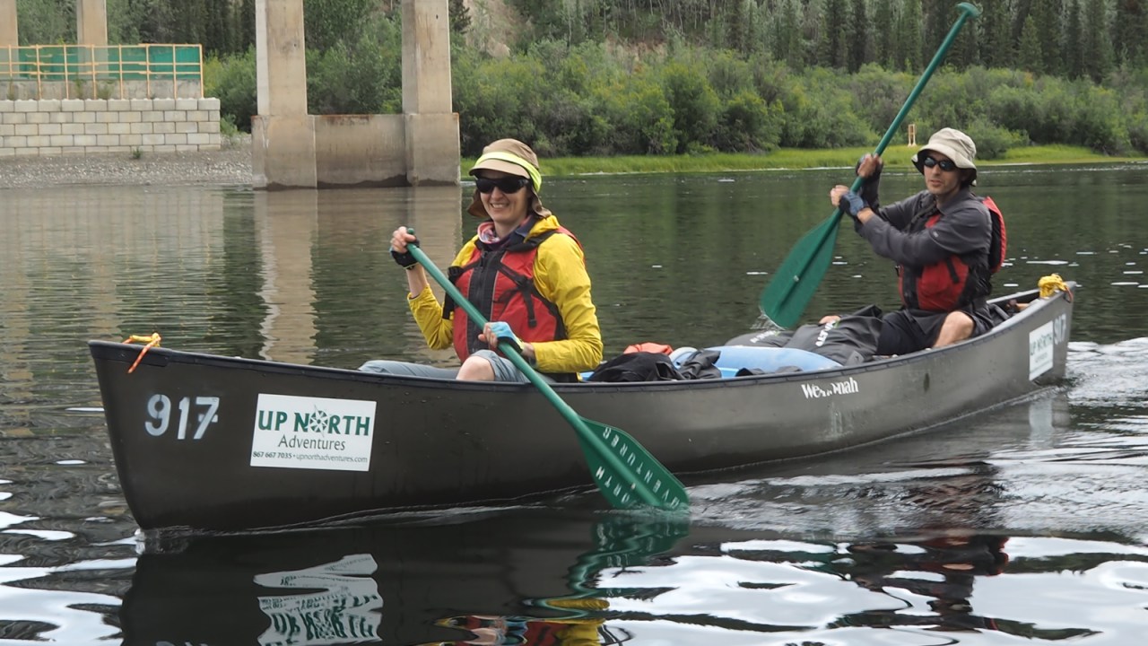
The Teslin gently flows from Teslin Lake in a northeasterly direction and joins the Yukon River at Hootalinqua. It’s the perfect river for a couple of rookie paddlers to cut their teeth. There are no rapids but the increasing current is ideal preparation for the much larger Yukon and its more challenging waters.
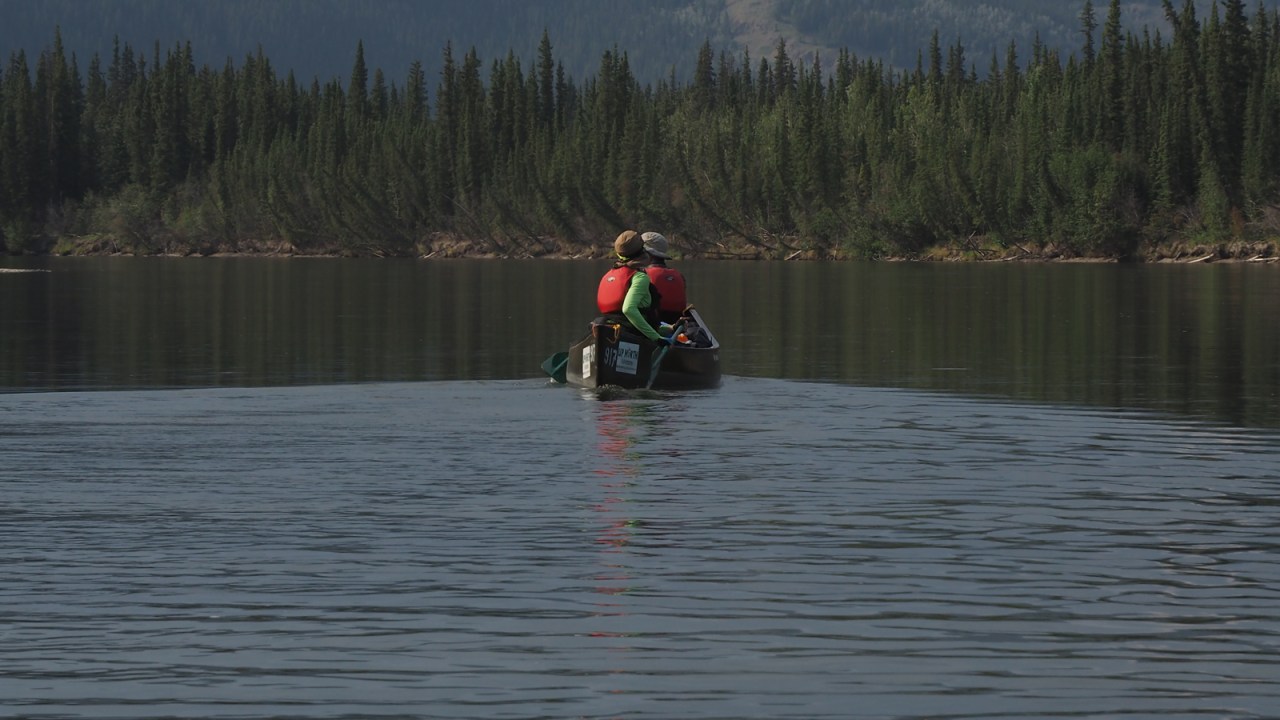
We pack the canoes and slip away down the river, happy to finally get out into the backcountry and let nature’s rhythm dictate our lives for a few weeks. It’s a familiar feeling, the soft, rhythmic dipping of the paddles, as we nearly silently travel down this liquid ribbon along the Big Salmon Range of the Pelly Mountains. Muscle memory is a wonderful thing as we quickly descend into wilderness with very little effort.
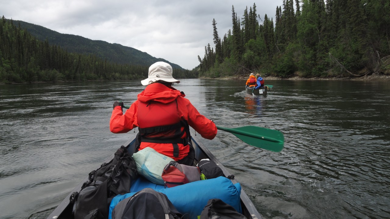
Alba and Gérard can’t really keep up with us as they try to find their own rhythm and learn how to navigate their canoe. When they drop too far behind, we are happy to just float and wait for them to rejoin us. They are learning and I can see they are enjoying it, despite sore shoulders and arms from the repetitive motion they are not used to.
I remember my first extended wilderness canoe journey on the Back River in the Northwest Territories and then newly created Nunavut in 1999. I had done quite a few shorter canoe trips in Alberta and British Columbia on rivers and lakes, but nothing like the Back River, the longest barrenland river in northern Canada. It was an experience that still occupies a prominent space in my life, a 10-week journey through some of our country’s remotest parts. There are no roads or settlements and help is a long way off. We were utterly alone. It’s an alien feeling to most of us but one I became addicted to. It doesn’t take long for that feeling to take hold again as we slowly paddle north.

We don’t go very far that first day, about 25 kilometres. No point in overdoing it as we have plenty of time, and we all need that time to let our minds and bodies adjust to a different pace and place. We find a well-used camping spot on river left and make it our home for the night.
Hoodoos and high cut banks line the river and in places, the forest comes right down to the water’s edge. Old burns go on for miles as new growth fills in the spaces between the silvered trunks, sentinels of the predominantly black spruce forest that once stood there and will again some day.
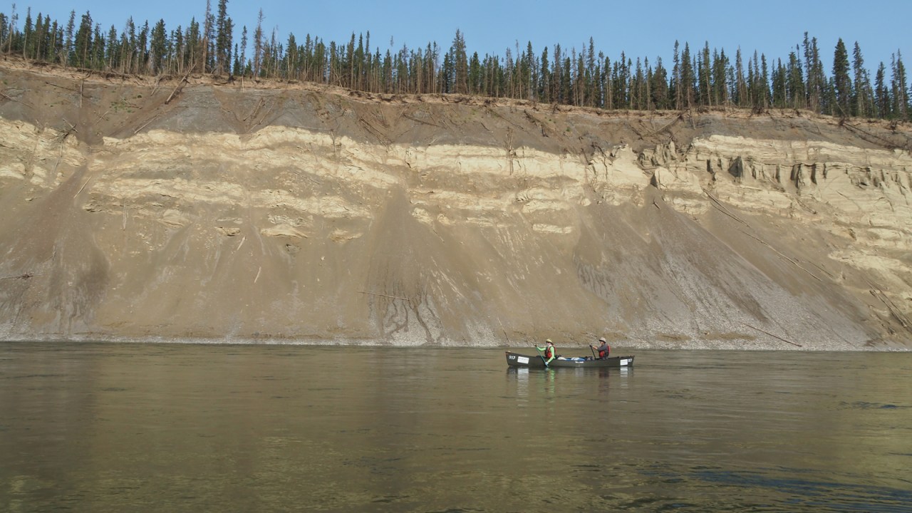
The river flows 200 kilometres from Teslin Lake before it joins the Yukon. The river has been travelled for countless generations by the local Inland Tlingit who hunted, trapped and traded as they followed seasonal migrations of fish and game along this river and others in the area. In the late 19th century, the Teslin was one of the first of the Yukon River tributaries to be prospected for gold by fortune seekers from the south but it lacked the payloads of the gold fields further north on the Yukon River.

We are not the only travellers on the river. We run into a group of Japanese paddlers who are all in solo canoes. I suspect they, too, are novices as they twirl and dance and turn along the river. When I ask how they are doing, one of them laments: “We are dying.” But they persevere as we hopscotch with each other all the way to Carmacks.

After four days on the river, we paddle into the much faster current of the mighty Yukon at Hootalinqua, once a bustling staging point for Yukon River steam ships travelling between here and Dawson City. Every winter, steamers would get dragged up on the shore of Shipyard Island before the river iced over. Because the river became ice free much earlier in the spring than Lake Laberge, Hootalinqua was a perfect place to keep steamers over the winter. Goods hauled from Whitehorse over land and ice to Hootalinqua during the winter could be shipped north much earlier that way.
The steamer Evelyn still sits on the island. It’s not clear what exactly happened to her but she was likely damaged on her last trip of 1913 and dragged up for repairs that never happened. Her engine was pulled and installed on another steamer. She still sits there today, although is slowly falling apart after more than a century on dry land.


Hootalinqua is busy. The camp site is full with paddlers who’ve come down the Yukon from Whitehorse and tell us tales of high winds and difficult paddling on Lake Laberge. We’re happy we’ve come down the Teslin without any weather issues other than a bit of rain. We decide to move to Shipyard Island to camp for the night. We have the place to ourselves until late in the evening when a group of German paddlers overshoot the island but manage to land downstream on the opposite shore. They haul their canoe upstream and ferry across to camp with us.

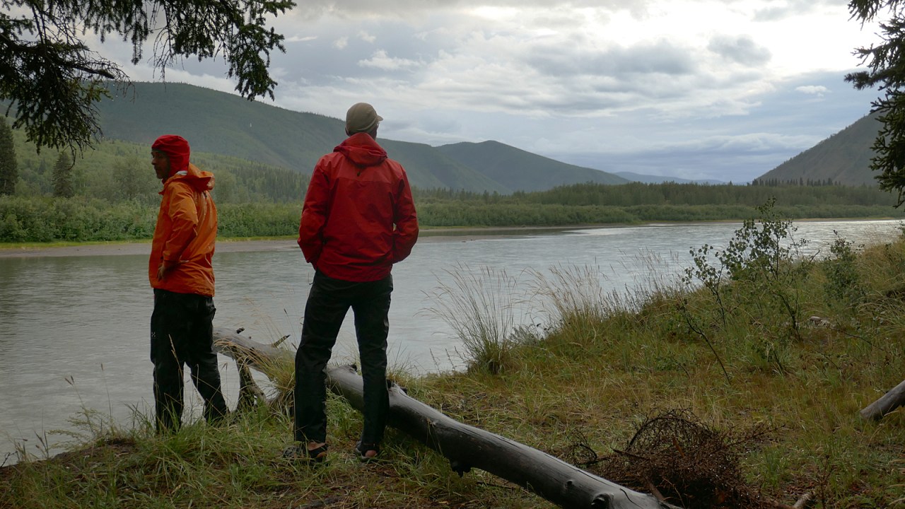
The days are long still at this latitude, although getting shorter as we approach the autumnal equinox. Sun sets are long and drawn out. There is never any urgency to find a camping spot before dark as we’re usually off the water hours before. It gives us the opportunity to pick and choose where we’d like to camp.

We’re seeing more and more wild life. Moose, bears and eagles become part of every day. Even wolves, otters and even a lynx that Jan and I passed at close range without noticing, but Alba did and could hardly contain her excitement. We are excited with her but also disappointed we missed seeing this elusive cat.

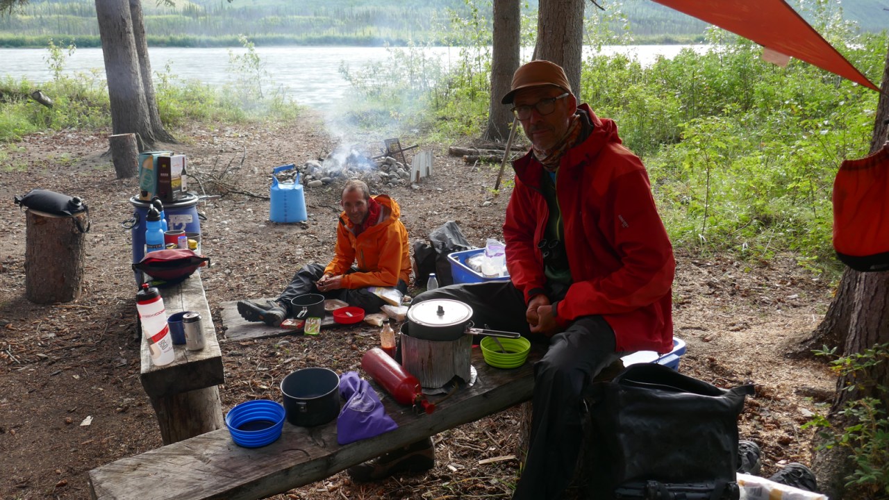
After a week of paddling, we arrive in Carmacks where the Alaska Highway crosses the Yukon River. We camp in the Coal Mine Campground on the edge of town where we have hot showers, do laundry and gorge on burgers and fries from the Camp’s restaurant.
We stop at the store the next morning and top up our food supply with fresh veggies and fruit and all the other necessities we will need for another week on the river. It’s a brilliant, sunny day as we slowly follow the meandering river away from town.
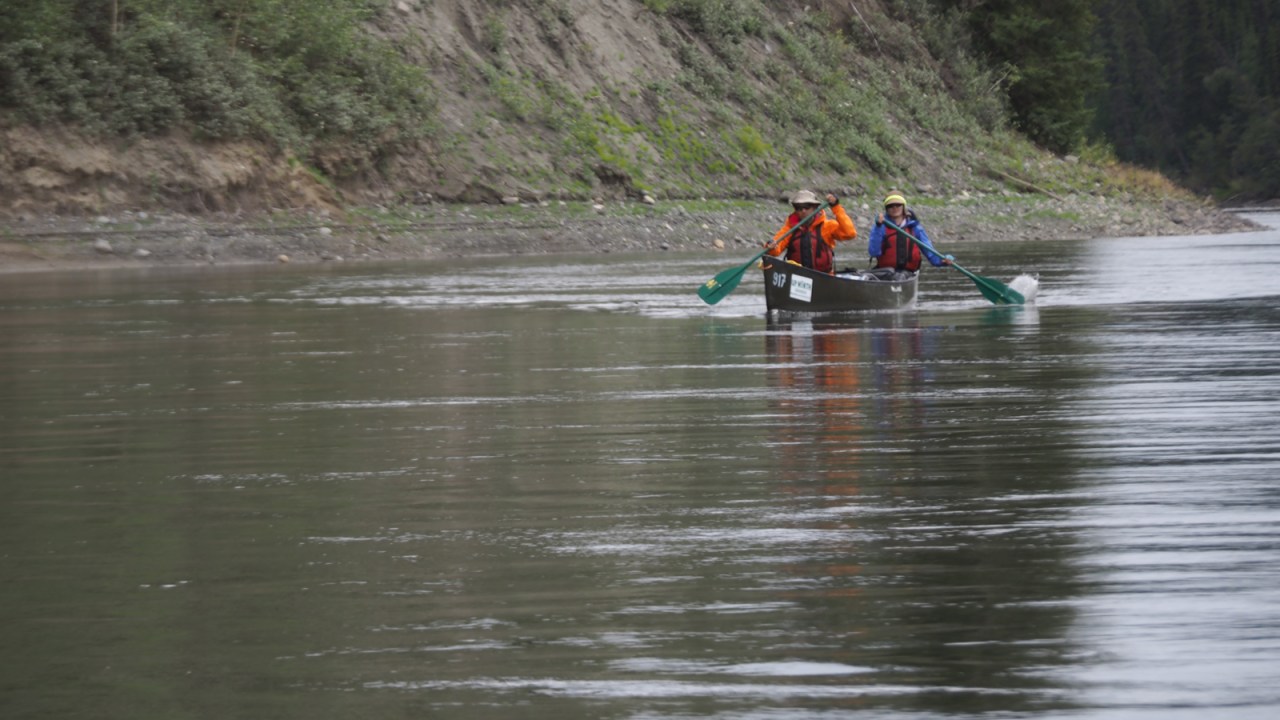
We’ve been preparing Alba and Gérard for a few days for the one and only rapid on the Yukon River we have to run: Five Finger Rapids. It’s an easy class II but looks intimidating as the river squeezed through a narrow opening between rock pillars. We’ve practised drawing and prying strokes, eddy turns and bracing the canoe. They’re ready.

We let them lead. Jan and I follow about 50 metres behind. Should anything go awry, we can pick up the pieces. But they run it perfectly and it’s over in no time. They have huge grins as we join up and continue to paddle close together through Rink Rapids and beyond to Yukon Crossing where we contemplate camping.

We land at Yukon Crossing but after wandering around the overgrown site we decide to keep moving to find a more open camp site. Most of the buildings that used to occupy the site are long gone. The only one left partially standing is the roadhouse and the outline of another, smaller building of what used to be a stable.
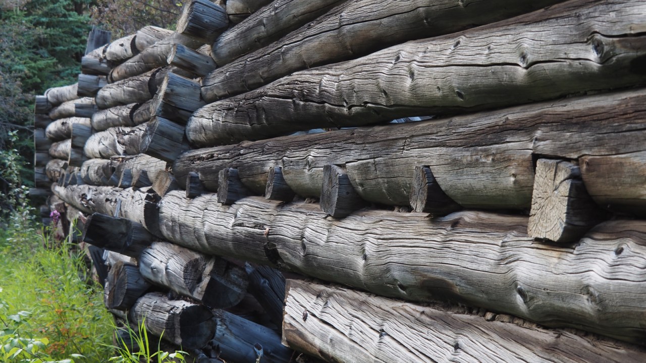

We paddle on a few kilometres to Merrice Creek and camp on a lovely site just above the river. There are cabins here, too, dating back more than a century. Built buy gold prospectors, the cabins are a testament to a bygone era. It’s home for the night.

The sunset is incredible as a squall moves through the area. We rush down to the river’s edge to get better views of the rainbow and the sky slowly going from orange to purple. It’s a mesmerizing display.


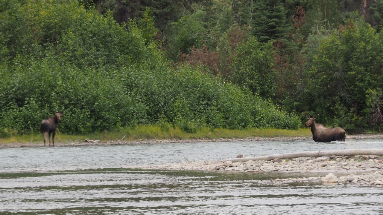
The River is big. Islands are a regular feature now with many channels to choose from. We often pick smaller channels hoping to see wildlife and it pays off. In one of these smaller channels we paddle up to a couple of moose standing in the river. We float by as the huge animals look at us for a moment before moving on.
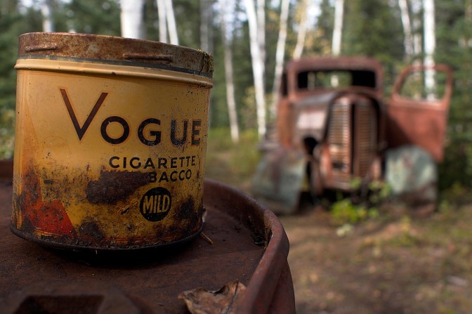
We pass the town of Minto and the Minto mine further downstream. Too much activity around here for us so we keep moving. As we approach Hell’s Gate, we choose a small channel on river right to get to a camp site at Blanshard’s woodyard. Jan and I camped here on our trip three years earlier and we want to show Alba and Gérard. The place is like a museum with many cabins in various states of disrepair, old vehicles and all kinds of other remnant from a bygone era.
The weather has been hot and sunny. After a few hours on the water, we are ready for some shade. The sun can be relentless. We don’t complain too much when the morning dawns with some cloud cover as we move on toward Fort Selkirk and the confluence with the Pelly River.
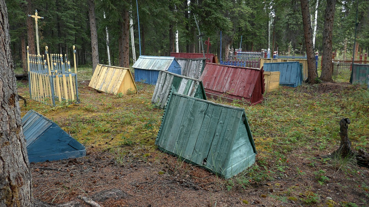
We pull in at Fort Selkirk to wander around this museum. The Selkirk First Nation (Northern Tutchone) have occupied this land for millennia as the area provided all the resources needed to live here. Chilkat traders from the coast travelled inland to trade with the Tutchone so that by the time the Hudson Bay Company arrived on the scene in 1840 there were already well-established trade routes and practises in place.
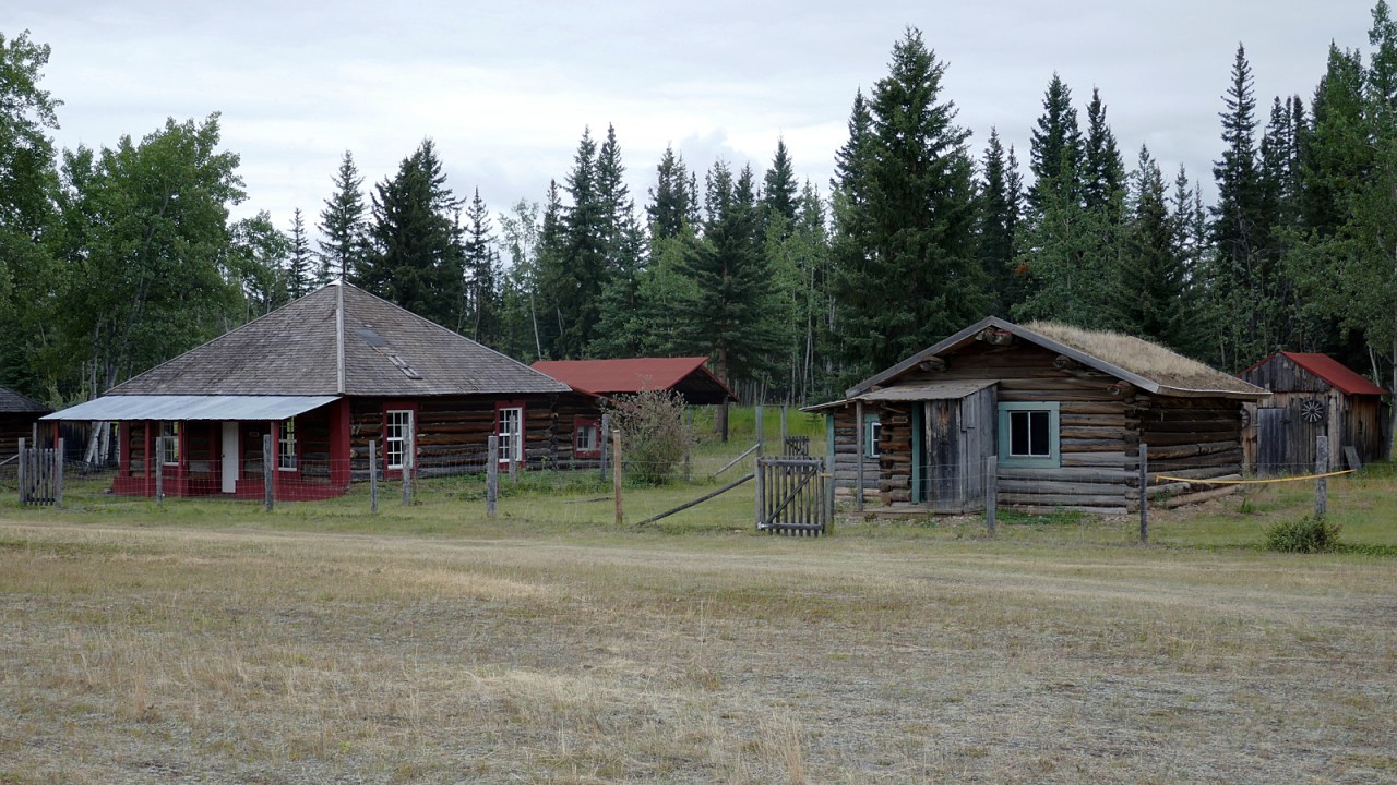
After a decade or so, the Chilkat traders had had enough of their competitors from the south and the trading post was looted and burned. The Hudson Bay Company chose not to rebuild the post. An independent trader, a Scot named Arthur Harper, reopened the post about 30 years later in 1888. He was able to make a go of it. Eventually, the HBC bought the post in 1938 but closed it in the early 50s. The building was put on a barge and removed.
Besides the various trading posts, there was a Northwest Mounted Police post, as well as a telegraph office and, in 1898, a 200-man strong Yukon Field Force was established here to assist with law enforcement during the gold rush. By the time the river boats stopped running in the 50s, the town slowly died and the residents moved to nearby towns of Pelly Crossing, Minto and Carmacks, all connected by the newly constructed Klondike Highway. The settlement has been gradually restored and is largely managed by the Selkirk First Nation as a museum that gets a few visitors passing by canoe.
We paddle on a few more hours and eventually camp at a well-used site on an island just past Seventeen Mile Creek. A while later, we are joined by a couple from Spain’s Basque country, Pais Vasco, and a flurry of Spanish resounds through camp. We dine together and sit around the fire swapping stories of our journeys.
We say farewell to our Spanish friends in the morning with a promise to meet again in Dawson City in a few days. We’ve been paddling anywhere between 45 and 70 kilometres per day. The current does most of the work so progress is swift, leaving time to hang out in camp and wander around.
We pass Brittania Creek where a giant sign announces a mine. I believe it’s an access road to the Casino Mine site that is on track to become the largest gold and copper mine in the Yukon. Regulatory processes have delayed the mine from opening but it does look like it’s going ahead in the next few years.
We camp on a high bank across from an island. We’re sitting around chatting, having a drink, and don’t notice the squall coming down the river until it’s almost too late. We get the tarp and tents up just in time as rain pours from the sky. It doesn’t last long.
As we prepare dinner, we notice a moose cow and calf crossing the river from the island to our shore. We watch in amazement as the cow uses her large body to shelter the calf from the fast current as they swim across. We carry on with dinner and notice them again a while later swimming back to the island. Moose swimming lessons, perhaps.

We keep watching the moose as they hang around on the opposite shore. I think they know we are here and perhaps this is why they’ve gone back across to the island. Eventually, the light fails and the rain returns. We head for the shelter of our tents and blissful sleep as the rain pattering on the tent sends us into dreamland.
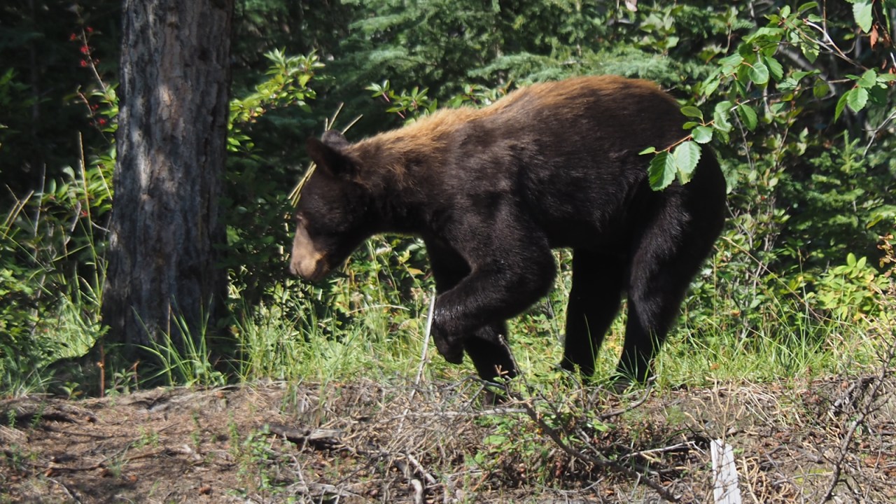
The moose are still there in the morning and we watch them tentatively get into the river at the southern tip of the island while we prepare breakfast and pack up our camp. Another movement on the island draws our attention away from the moose. Two black bears are wandering down the shore toward the moose. They are large bears but could still be with a sow, although, we never see one.
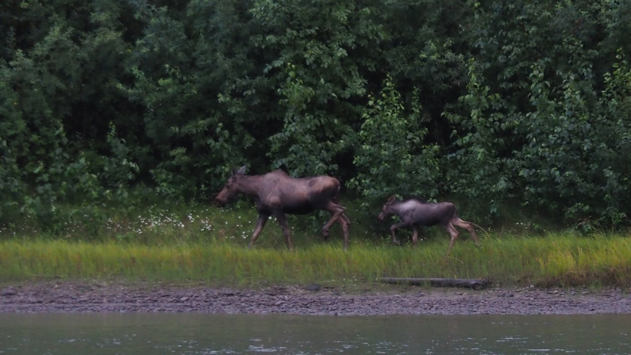
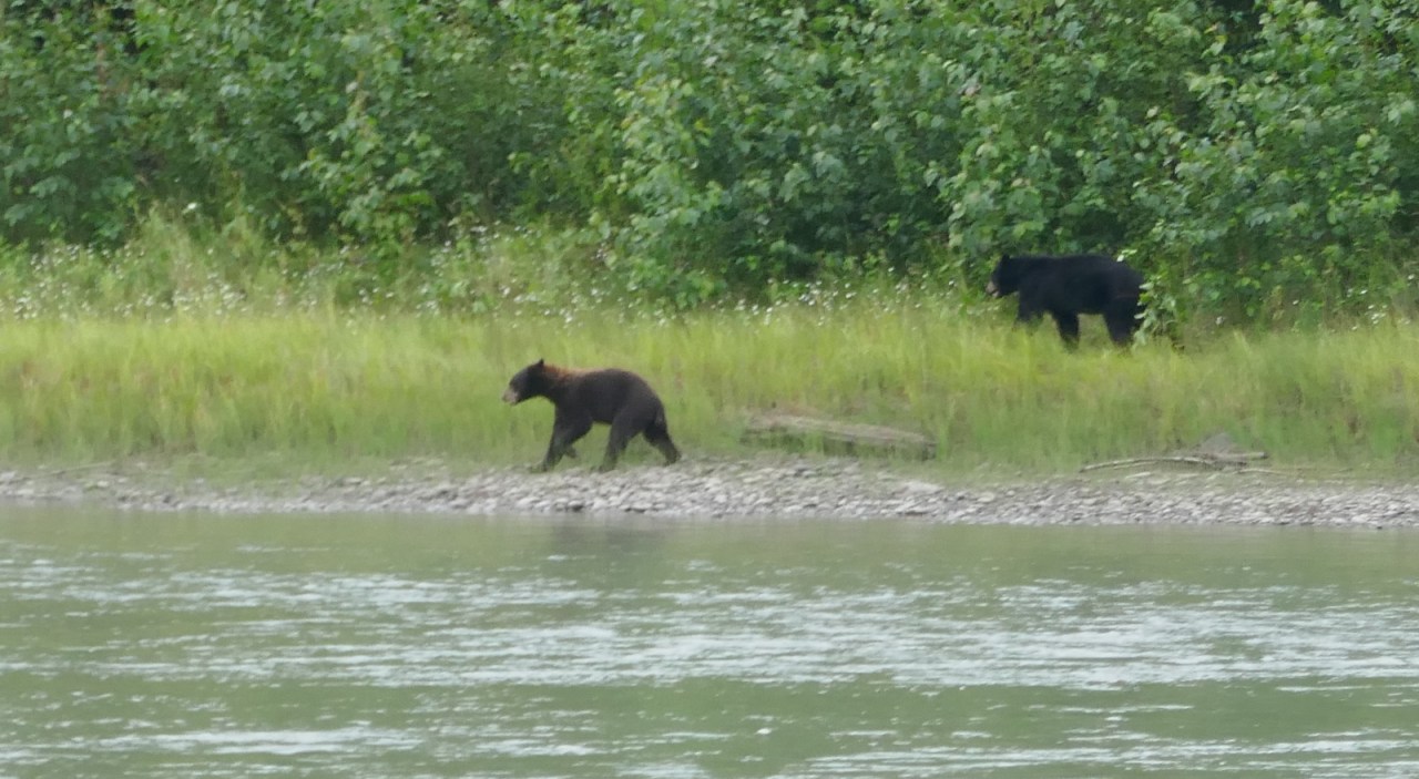
The bears are cavorting and play-fighting with each other as they scamper along the shore towards the moose. The cow gets in the water and is followed quickly by her calf as they swim across again. The bears disappear into the forest of the island and we don’t see them again. The moose disappear from view once they’ve gained our shore.

We marvel at what we’ve seen while we set off down the river. It’s always special to see an animal. To see the moose and bears in such close proximity was a real privilege. We paddle on in high spirits in anticipation of what lies ahead.
We pick our way south trying to stay in smaller channels hoping to see more wildlife. We see eagles and even a porcupine but large mammals are elusive today, but we can’t stop talking about the moose and bear show we had seen that morning.

There is more mining and exploration evidence along this stretch of river at Coffee Creek and Thistle Creek, as well as the Kirkman Creek homestead. We pass them all by looking for a place to camp. The river banks are either high and difficult to access, or overgrown with willow. Camping is scarce so we haul in at a water survey shed to see if we can camp there but it’s a high bank and we don’t find much level ground, so we keep moving. A few kilometres downstream we spot a clearing in the trees on an island just north of O’Neil’s Landing. It turns out to be a very well used camp site, complete with a make shift biffy about 50 metres down a trail in the forest away from camp.

It’s a lovely evening and we wander the shore of the island in the failing light. Just before sunset, a small group of paddlers float by in a couple of rafted canoes. They are in the middle of the channel and seem happy to continue to drift north on the current, despite the late hour.
In the morning we paddle by the camp of the people we had seen drift past the previous evening. They are camped in the willows just upstream of a cabin where Jan and I camped on our 2016 trip. As we paddle to shore below the cabin we notice movement in the trees. Two bears are hanging around the cabin. We back off and just watch them. One of the bears is sitting at the shore while the other is walking near the cabin.

We observe the bears for a few minutes and decide its best to move on. We are now at the White River confluence, named in 1851 by the Hudson Bay’s Robert Campbell on his exploratory journey on the Yukon. He named it for the colour of the water which looks like milky coffee and is caused by a combination of silt and volcanic ash from a massive eruption in the Wrangell and St. Elias Mountains to the west.
The White River’s silt completely overpowers the Yukon and we continue our journey more vigilant for obstacles hidden in the opaque water. Hitting a submerged tree can be disastrous in the fast current.

With the added silt from the White River, islands in the Yukon River become more numerous. There are many shallow sand bars, partially submerged. Sometimes, the only cue giving them away is a slight riffle in the water, or twigs bobbing up and down in the current. We remain alert for possible obstacles.
On our previous trip, Jan and I were windbound on a sand bar for most of a day. This can be a windy place as is evident in the forest lining the shore. It is full of broken trees for many miles. This time, there is almost no wind and we bask in the warm sun navigating the many small channels as we look for fun, little rapids to speed us along.
We decide to have a shorter day and haul out after only 40 kilometres on a large, flat sand bar with a few shrubs providing some shelter in case the wind comes up. We have a lazy afternoon and evening as we rest and lounge by the fire.

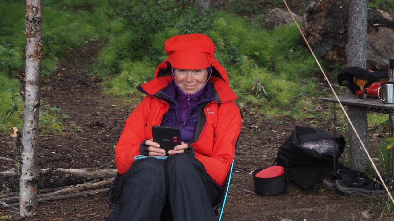
Alba has had some problems with her hands. We don’t know what the problem is but it’s difficult for her to grip her paddle or do any kind of fine motor skills with her fingers. It’s because of the cold temperatures we’ve been experiencing and having wet hands most of the time has not been helping the situation.
We are not far from Dawson City now and have the luxury of time, so, given the problem with Alba’s hands, we travel only about 32 kilometres the next day as the weather turns cold again. We camp at Mechem Creek within a moderately short day ahead to get to Dawson City. We will have to have Alba’s blistering hands looked at when we get to town and see what is going on.
The weather is unstable and cool with intermittent rain and sun as we hang around the fire whiling away the day. There are some very old cabin remains in the forest behind camp, likely dating back a little over a century. Late in the day, three canoes haul in and join us at the small camp site. We spend the rest of the evening together chatting over dinner and drinks.

The next day, the weather is warmer and there is no threat of rain. We pack up and get into the current for our last few hours on the river to Dawson City. Not far from there we spot a lone paddler in a red canoe, and we know who it is: one of the Japanese paddlers we met a couple of weeks earlier on the Teslin River. His friends went home from Carmacks and he continued solo. I call out to him and ask him if he’s still dying. “Yes,” he replies, with a big smile on his face.
We arrive in Dawson city in the early afternoon and our Spanish friends have also just arrived. We have a little celebration on the shore as Alba and Gérard have completed their first canoe trip. We remind them how we turned them on to bike touring six years earlier when they joined us on their first-ever bike trip in northern Norway, and wonder if they have found another outdoor addiction.

We make several trips hauling our gear to the hotel and have luxurious hot showers before seeking out Bombay Peggy’s bar for a drink, followed by an excellent meal at the Triple J Hotel restaurant across the street from Diamond Tooth Gertie’s Gambling Hall where we catch a show with dinner the following night, capping off another great canoe trip.

Our bicycles have also arrived here and we begin preparing to continue our journey north from here on the Dempster Highway, or as I like to call it, the Carretera Boreal, a name inspired by the Carretera Austral Jan and I cycled five years ago in Patagonia. But first we need to find out what is going on with Alba’s hands. That will determine what we do next.

Stay tuned.

Paul,
I have been following your blog.
Hope it snows and snows so you will have good skiing again this year.
Lise and I are hanging in there and glowing older gracefully.
Lets get together for a breakfast.
Hope you and your lady are well.
Send some news,
Wayne Helfrich
What a beautiful series of pictures and travel story from your beautiful country. Thank you for sending.
Dankuwel! Glad you enjoyed it, uncle.
Thank you both for all the lovely travelogues. I enjoy them so much. You do all my traveling for me nowadays. Love Auntie Carol.
Sent from my iPad
>